|
(A)
Prologue |
|
BATFISH arrived Pearl
from second war patrol on 15 April 1944. Eighteen day refit period by U.S.S.
PROTEUS and Submarine Base during which time converted Nos. 4A and 4B MBT to
FBT. Three days training. Depermed and sound tested on 9 May. Ready for sea
10 May. Underway for Midway 1330(VW) 10 May arriving 14 May. ON 15 May,
Lieut. Comdr. J. K. Fyfe, U.S.N. relieved Lieut. Comdr. W.R. Merrill as
Commanding Officer. Conducted training exercises with U.S.S. GREENLET, U.S.S.
CHALCEDONY and U.S.S. PC 587 on 16-24 May, firing 9 exercise torpedoes,
night gun firing and day battle surface. Ready for sea 26 May 1944 |
|
(B)
Narrative |
|
26 May |
| 1530(Y) |
Underway from
Submarine Base pier, Midway, for patrol area. Air coverage by two planes of
Marine Air Group 23 until 1800(Y). |
|
27 May
- 3 June |
|
Proceeding patrol
station conducting daily training dives, ship drills, fire control drills
and battle surfaces enroute. |
|
1 June |
| 2100(X) |
515 miles from edge of
area. Went ahead full speed on 3 main engines (16 knots) so as to arrive
prior daylight 3 June. |
|
3 June |
|
Hereafter all times
are (-9) unless otherwise noted. |
| 0618 |
Entered area. Set
course to pass 20 miles south of Tori Shima and since we are due to be out
of this particular locality at midnight tonight continued patrol at full
speed. |
| 1102 |
Sighted Tori Shima
bearin 297� True, distant 47 miles. |
| 1135 |
SD contact (Aircraft
contact #1) 26 miles, closing. |
| 1136 |
Dove. |
| 1222 |
On coming up to 53
feet for an SD sweep prior to surfacing picked up submarine on surface
bearing 148� T, distant about 12,000 yards. (Ship contact #1.) Commenced
approach. The closer this boat got the more I was convinced she was the
WHALE, and after the range had closed to about 3000 yards I definitely
established her identity as friendly. At |
| 1305 |
Fired the recognition
smoke bomb and surfaced. Exchanged calls with KINGFISH. |
| 1420 |
Sighted Sofu Gan
bearing 207� T. |
| 1446 |
SD contact (Aircraft
contact #2) at 20 miles - Dove. |
| 1600 |
Surfaced. |
|
4 June |
| 0200 |
Lots of Jap activity
on 450 Kcs. |
| 0341 |
Dove with Tori Shima
bearing 145� True, range 20 miles. Went to 350 feet for BT card. |
| 0512 |
Sighted four columns
of smoke bearing 047� T. Went to normal approach course and speeded up to 6
knots. Although we ran at this speed for 2 3/4 hours no further evidence of
smoke or ships could be seen. |
| 0800 |
Planed up to 45 feet
for a good look around and to take SD sweep prior to surfacing. Sighted a
small patrol vessel or fishing trawler (Ship contact #2) about 12,000 yards
on course 340. At |
| 0815 |
ship disappeared
behind SE end of island so after taking SD sweep, surfaced. However a plane
contact 6 miles, closing, (Aircraft contact #3) drove us down again
immediately. My intention was to run to southward on the surface to see if
anything had developed south of the island and to try for an attack position
in case we made contact. |
| 0824 |
Getting ready to
surface again, when the trawler previously sighted came around the SW end of
the island. He stayed on a north westerly course for about 15 minutes and
then headed south. He was a two-masted, single-stack trawler similar in
appearance to the MINATO MARU shown in ONI 208-J, revised. |
| 0912 |
Sighed one SALLY,
flying low on a southerly course, crossing about 6 miles ahead. (Aircraft
contact #4.) |
| 1112 |
Sighed three SALLY's
flying low also on a southerly course. It is beginning to look like the AAL
flying schedule, flying by 12 minutes after each hour. (Aircraft contact
#5.) |
| 1212 |
No plane contact. |
| 1230 |
Surfaced with Tori
Shima bearing 142� T, distant 15 miles. Plane contacts at 18 and 22 miles
both opening, (Aircraft contact #6) so apparently they were there on time
after all. Set course 270 and cleared area at full speed. |
| 1312 |
I found it hard to
believe but SD contact (Aircraft contact #7) at 18 miles, moved in to 17 and
then opened, disappearing at 22. Land contact at this time 25 miles. It's
150 miles from here to Hachijo and it looks like the planes leave every hour
on the hour and cruise at 150 knots. |
| 2016 |
Dove to wash out #4A &
B. Now using those tanks as ballast tanks. |
| 2028 |
Surfaced. |
| 2200 |
Slowed to 10 knots. |
|
5 June |
| 0420 |
Dove for trim and BT
card. |
| 0516 |
Surfaced - continued
patrol to westward across convoy routes. |
|
6 June |
|
Patrolling western
half of area. |
| 0425 |
Early morning trim
dive. |
| 0550 |
Surfaced. |
| 1300 |
Went ahead at 15 knots
in order to arrive off Tanega Shima before daylight tomorrow. |
|
7 June |
| 0359 |
Dove 17 miles east of
Tanowaki Bana on Tanega Shima. Submerged patrol north and south along 100
fathom curve. |
| 2000 |
Surfaced in bright
moonlight and stood off to eastward at slow speed patrolling across the Van
Diemem - Tokyo route. |
| 2400 |
Reversed course. |
|
8 June |
| 0436 |
Dove with Toi Misaki
bearing 305� T distant 16 miles. Submerged patrol north and south along 100
fathom curve. |
| 0645 |
Sampan fishing fleet
started coming out. From this time until about 1600 there were anywhere from
two to eight sampans in the vicinity. They were about half in half sail and
power boats and varied between old dilapidated looking hulks to fairly new
and large boats. Although their nuisance value was considerable we had no
trouble remaining undetected. |
| 0940 |
1 MAVIS (Aircraft
contact #8) flying N.E. |
| 1030 |
1 SALLY (Aircraft
contact #9) flying N.E. |
| 1122 |
1 SALLY (Aircraft
contact #10) flying north disappeared over Toi Misaki and apparently landed. |
| 1305 |
Sighed a ship (MFM)
bearing 290� T, distant about 8000 yards on a southerly course, speed 10
knots. (Ship contact #3.) |
| 1315 |
Range is now 4500
yards. Ship identified as MURO MARU (Page 19, ONI 208-J, rev.), a properly
marked hospital ship. In addition to the hull, stack, and bridge markings,
she had a big cross painted on what appeared to be a tarpaulin that was hung
between the bridge and the main mast. She was just inside the 100 fathom
curve, course 190� T, speed 10 knots. Broke off approach. |
| 1936 |
4 BETTY's (Aircraft
contact #11) flying south. |
| 2019 |
Surfaced. Navigation
lights at O Shima, Toi Misaki and Hi Saki were burning, with reduced
intensity. In view of this fact and because of the rather active air patrols
seen all day thought perhaps something might be coming through so decided to
patrol this vicinity in a N-S direction during the night. Moon nearly full,
cloudless sky, calm sea, land clearly visible - No luck. |
|
9 June |
| 0417 |
Dove. Patrolling off
Toi Misaki again today. |
| 1030 |
Sighted two planes
(NELL) distant 3 miles bearing 049� T flying north. (Aircraft contact #12.)
Again, from 1-8 sampans of nondescript appearance were in sight most of the
day. |
| 2013 |
Surfaced. Decided to
patrol to northward along coast during the night so as to be in a position
to dive off Fuka Shima in the morning. |
| 2136 |
Reversed course and
started an approach on a radar pip bearing 212� T, distant 20,000 yards. Pip
disappeared at 12,000 yards. Stood on down the bearing but it never appeared
again and since nothing was in sight came back to course 030 and broke off
the approach. This was the first of three phantoms on which we made
approaches during the night. (See radar section for complete information and
possible explanation.) |
| 2344 |
Tracked another
phantom. |
|
10
June |
| 0036 |
Made approach on
another phantom bearing 335� T distant 18,000 yards. Disappeared at 13,000
yards only to show another pip at 19,500 yards. Think we have figured out
this disconcerting phenomenon. The night is unusually clear, calm and with a
very bright moon and it is believed that with the existing atmospheric
conditions we are getting pips on land that is 60-70 miles away and this
echo is showing up on the sweep succeeding that of the pulse that cause
them. |
| 0305 |
SD radar contact 12
miles, closed to 9, faded out at 9 1/2 miles. (Aircraft contact #13.) |
| 0430 |
Dove. |
| 0652 |
Sailing sampan bearing
225� T, range 6000 yards. This was first of two sampans seen during the day. |
| 0930 |
Sighted black and
white horizontal striped buoy with red base, lighted - position: Lat.
32�-38'N, Long. 132�-02'E. |
| 1058 |
Sighted mast of ship
bearing 287� T, on a southeasterly course, range 11,000 yards. Commenced
approach. (Ship contact #4.) |
| 1215 |
After a long approach
against the current, the range closed sufficiently to recognize the target.
She was a MFM type and had a silhouette that was different in detail from
anything in the book. She had a high poop forward mounting two guns of
fairly large caliber. A deep well forward and a high foremast with two
yardarms just forward of the bridge which was high and long. The amidships
superstructure was also high and the single funnel just barely cleared the
top of the bridge. A high poop deck aft on which was mounted one or more
guns of about the same caliber as those forward. The mainmast was the same
height as the foremast. From all appearances, I would judge she was a
training ship of some kind because of the large number of men who were
topside and around the guns apparently engaging in drills; and also because
she was just steaming around, and seemed to be headed in no particular
direction. Two signal searchlights were in use and since they were trained
on the beam, and since there was no one out there to talk to, I surmise they
were holding signal drill. |
| 1220 |
Went to battle
stations submerged. |
| 1243 |
Fired tubes 1, 2 & 3
using a 1� spread, 70 port track, 1800 yards. |
| 1244 |
One hit amidships.
Target literally blew up in my face. This was the most terrific explosion I
have ever seen and target sank in less than two minutes, slightly by the
stern. |
| 1247 |
One very loud
explosion which jarred the BATFISH considerably. Went to 250 feet and rigged
for depth charge. At the time I thought this was a bomb, but since I had
seen no planes during the approach, post mortem held later makes me think it
was either a magazine or a boiler on the sunken ship blowing up. At the time
I was making a periscope sweep and nothing was in sight as far as I could
see. However since the sea was glassy calm and I only had 1 foot of
periscope out, my horizon was less than 2500 yards. |
| 1300 |
Commenced reload
forward. Since this attack was made 4 miles off Shimanoura Shima and in
plain sight of the lookout station, I expected the Chidoris to be out of
Bungo Suido in full force, so cleared the immediate vicinity to get back
across the 100 fathom curve and then headed on course 145 to patrol the 150�
line from Fuka Shima. |
| 1445-1650 |
Depth charging in
distance. Nothing in sight in periscope. |
| 2009 |
Surfaced. |
| 2032 |
SD contact 10 miles,
moved in to 7 and back out to 12. Picked up on SJ bearing 109� T, 20,000
yards so he must have been flying low. (Aircraft contact #14.) |
| 2145 |
Flare sighted bearing
175� T, about 4000 yards away. Turned away at high speed. |
| 2200 |
Picked up radar signal
on APR, 145 Mcs., very strong. He seemed to have us as he would sweep back
and forth and then stay on us for about 15 seconds. This was deduced from
the fact that the signal would increase from weak, to very strong to weak
and then back to very strong, and remain there for 15 seconds or so. At this
time we were 30 miles from Ashizuri Saki radar station. |
| 2346 |
SD contact 12 miles.
(Aircraft contact #15.) Closed to 9 and then to 7 so at |
| 2351 |
Dove because it looked
like he had us cold. |
|
11
June |
| 0050 |
Fast screws moving
down the starboard side - fairly close. Sounded like a small, high-speed A/S
vessel. |
| 0145 |
Started to surface.
Plane contact (SD) 6 miles, closing. (Aircraft contact #16.) S.J. picked it
up bearing 075� T, 4 miles. Dropped down to periscope depth. |
| 0210 |
S.J. contact bearing
090� T, 4600 yards. No sound contact. Sighted what appeared to be a torpedo
boat (Ship contact #5) search on a westerly course. The Nips seem to be
looking for somebody tonight. |
| 0416 |
Surfaced. |
| 0427 |
Dove 18 miles off
Okino Shima. Decided to patrol south and east along 100 fathom curve during
the day. |
| 0458 |
Sighted a PC type A/S
vessel bearing 023� T, heading directly at the spot where we dove. (Ship
contact #6.) It passed about 1200 yards astern. Looks like the Japs cut us
in again and I would like to know for sure if they actually have us in their
radar or if they are D/F ing our S.D. which we are keying intermittently and
at odd intervals. I don't like to secure the SD since the moon is so bright
but, at the same time, it's rather disconcerting to be tracked so obviously.
Since moonrise is not until 2316 tonight and since we will be about 12 miles
south of Ashizuri when we surface, I'll have a good chance to find out just
what the score is. |
| 0725 |
Sighed 2 PC's bearing
294� T, distant 8000 yards patrolling on a westerly course. (Ship contact
#7.) |
| 0957 |
Depth charging in
vicinity of yesterday's attack. |
| 2016 |
Surfaced. Headed
southwest to patorl the 160� and 150� convoy routes. Night dark and
overcast. Strong intermittent radar signals on 97 and 147 Mcs. |
| 2215 |
S.J. radar contact,
bearing 235, 10,000 yards. It's a plane and is coming in fast. Lost contact
at 8000 yards. (Aircraft contact #17.) |
| 2217 |
Dove, SJ radar contact
4000 yards. O.O.D. saw exhaust trails of a 4-motored plane. 10 minutes
before this contact, a strong signal on 147 Mcs. was picked up on the APR
and it seemed to be sweeping back and forth across our bearing. It kept
getting louder and at the time contact was made on the SJ it was extremely
strong and sharp. The Japs have apparently borrowed a page from our A/S book
as regards radar equipped search plane tactics. I have now decided that the
plane contacts of last night were not due to our S.D. being D/F'd and its
value in an area like this far exceeds its disadvantages. If this plane had
not been coming in low the S.J. undoubtedly would have had no indication of
a contact and we might have had our ears pinned back as a consequence. |
| 2316 |
Surfaced. Plane
contact at 8 miles, moving in. It looks like the Jap gambit tactics are
similar to ours too. (Aircraft contact #18.) |
| 2318 |
Sought solace in the
deep. |
| 2350 |
Surfaced. Turned south
at 15 knots to try and evade long enough to get our battery charged. Could
still hear signals on 147 but they swept on by us. |
|
12
June |
| 0100 |
Changed course to 325�
T to patrol 160-340 line and to arrive at 100 fathom curve off Bungo Suido
before daylight. Battery just about up. |
| 0130 |
SD contact 12 miles
(Aircraft contact #19.) |
| 0132 |
The APR showed he was
on us again and coing in. Dove when range was 6 1/2 miles. |
| 0235 |
Surfaced. Radar
signals on 97 and 147 Mcs. |
| 0240 |
He got us again. SD
contact 18 miles. (Aircraft contact #20.) |
| 0244 |
Plane closed to 9
miles, also picked up on SJ bearing 035� relative. Dove. |
| 0330 |
Surfaced. All clear. |
| 0335 |
Radar signals on 147
Mcs. |
| 0349 |
SD contact 11 miles
coming in very fast. Dove. (Aircraft contact #21.) since it was nearly
daybreak decided to stay down for rest of day. |
| 0512 |
Got a cut which showed
us to be 32 miles south of Kanei Saki. The combination of a two knot
northeasterly set, and a very efficient plane patrol has prevented us from
reaching our intended patrol line. Successive cuts showed that trying to
beat up against the current was futile when running at our normal slow
submerged speed. (40 turns). We ran at 50 turns on course 270 and made good
0.9 knots along course 300� T. |
| 0954 |
Sighed 3 patrol
bombers, (NELL) bearing 321� T. (Aircraft contact #22.) |
| 1215 |
Ran around and then
under a long fish net. Estimated this net was at least 2 miles long,
supported by the usual glass balls, and with marker poles flying a read and
white flag every 500 feet. The two ends were anchored well inside the 100
fathom curve, but the catenary extended nearly 2000 yards out. |
| 1710 |
Heard 11 depth charges
or explosions in the distance. Nothing in sight thru periscope. |
| 1732 |
Heard 4 more distant
explosions. |
| 1743 |
Ran the periscope up
again to see what was going on and nearly pushed the end of it through a
single engine, float type biplane. Went deep but I don't think he saw us
because he didn't drop anything. (Aircraft contact #23.) |
| 1801 |
4 more depth charges,
still far away. |
| 1828 |
6 more depth charges.
I have kept nearly a constant periscope search for the past half hour in
hopes that this depth charging was indiscriminate and presaged a convoy
coming through but was unable to sight anything larger than a sampan. |
| 1935 |
Sighted the upperworks
of a ship showing a large red light and two white lights. Since it was dusk
I was unable to distinguish any particular features except that she was
large and had two stacks. She was on an easterly course and was coming from
the direction of Bungo Suido. (Ship contact #8.) |
| 1956 |
Ship is now close
enough to distinguish the red light as a large, lighted red cross, reflector
lights mounted on sides to show white hull and green striping burning
regular running lights and in all respects looking and acting like a bona
fide hospital ship. This is our second hospital ship in four days and a
beautiful target like that certainly makes one's trigger finger itch. I
almost prayed for him to make one false move. He passed about 4000 yards
abeam heading for Ashizuri Saki. Identified as the TAKASAGO MARU. |
| 2028 |
Surfaced. AH 8000
yards on starboard quarter. Radar signals on 97 and 145 Mcs. on APR, both
intermittent and at odd intervals. Stood off to southward at standard speed. |
| 2130 |
c/c to 110� T. |
| 2330 |
Sent BATFISH serial
One to Comsubpac. |
|
13
June |
|
Patrolling to eastward
in new area. |
| 0430 |
Dove. |
| 1244 |
Surfaced. |
|
14
June |
| 0417 |
Dove. |
| 0445 |
Sighed large armed
trawler bearing 184� T on a northerly course, speed 6 knots. He passed about
8000 yards astern and was similar in appearance to MINATO MARU, shown in ONI
208-J, revised. He was armed with a 3-inch gun forward and had several
machine guns mounted at various locations around the bridge. (Ship contact
#9.) |
| 0906 |
Surfaced. Patrolling
across convoy route. |
|
15
June |
| 0418 |
Dove. |
| 0857 |
Surfaced. |
| 0942 |
SD contact at 26
miles. (Aircraft contact #24.) Disappeared on screen at 28 miles. |
| 1108 |
SD contact at 18
miles. (Aircraft contact #25.) |
| 1206 |
SD contact at 28
miles, moved in to 24 and disappeared at 29. (Aircraft contact #26.) |
|
16
June |
| 0408 |
Dove to patrol off
Muroto Zaki and southeast coast of Shikoku during day. |
| 1603 |
Sighted tug bearing
323� T on southerly course. Passed about 3500 yards abeam. (Ship contact
#10.) |
| 2014 |
Surfaced. Strong radar
signals on 97 Mcs. Heard the latest good war news and decided to patrol
slowly across Kii Suido in hopes that some naval units would come out to try
and make a dash for Saipan. |
|
17
June |
| 0404 |
Dove off Ichie Saki.
Patrolling between Ichie and Shiono Misaki. |
| 0615 |
Ran through a Japanese
fishing net in low visibility. |
| 1213 |
Sighed Chidori type
torpedo boat bearing 353� T, at 8000 yards patrolling inside the 100 fathom
curve between Ichie Saki and Shiono Misaki. (Ship contact #11.) |
| 1300 |
Sighed PC type patrol
boat on an easterly course bearing 028� T. (Ship contact #12.) |
| 1306 |
Sighed small coastal
type AO coming out of rain squall bearing 356� T on a northwesterly course
at a range of about 3500 yards. Unable to close. (Ship contact #13.) He was
about a 500 tonner and similar to our YO type. |
| 1320 |
Sighted PC boat,
patrolling on a northerly course bearing 332, range 5500 yards. |
| 2025 |
Surfaced. Found part
of the Jap fish net wrapped around the conning tower and discovered that we
had been dragging a sizable section of it astern of us all day. |
| 2030 |
Spent a half an hour
dodging Jap picket boats. They conveniently showed lights at odd intervals
however and presented no difficulties. |
|
18
June |
|
Patrolling west and
east across Kii Suido. |
| 0344 |
Dove to patrol off
Shiono Misaki during the day. |
| 0620 |
Sighted sampan fishing
fleet coming out. 5 of them altogether. |
| 0735 |
Sighted patrol boat
bearing 338� T, range 11,000 yards. (Ship contact #14.) He took departure at
Shiono Misaki and headed on a course of about 135� T. We will look into that
route tomorrow. |
| 0900 |
Sighted a 2-engine
patrol plane bearing 025 at about 7 miles. (Plane contact #27.) |
| 1029 |
One "PETE" bearing 317
at about 8 miles. (Plane contact #28.) |
| 1132 |
Another "PETE" bearing
019 on a northeasterly course. (Aircraft contact #29.) |
| 1248 |
Sighted coastal AK and
a small coastal AO bearing 069� T, distant about 12,000 yards. Commenced
approach. (Ship contact #15.) |
| 1300 |
Identified the A.K. as
a MFM ship similar to the MAYATI MARU, page 147 ONI 208-J, revised. She had
a crow's nest on the foremast with two lookouts and had four or five
lookouts forward and aft on the port (seaward) side. I figured at first that
she was acting as escort for the tanker but on sober second thought decided
she was not because whereas she had been on the seaward quarter of the oiler
when we first made contact, she was just forward of the beam when we fired.
The oiler had an appearance similar to a U.S. YO, except perhaps, she was a
little larger. The AK was painted grey, the oiler a dirty red. Thought I
could get them both with a three fish spread so at |
| 1328 |
Fired three torpedoes
on a 120 port track, 2100 yard range with a 6 foot depth setting. |
| 1329-30 |
One hit in the AK
which broke her in half. She sank with a 50� rise angle in less than a
minute. The oiler poured on the coal and turned toward the beach. By
tracking the other two torpedoes by sound, determined they passed astern. |
| 1331-25 |
Two end of run
explosions at the foot of a well terraced garden which ran right down to the
water's edge. I hope we ruined their potato crop. Perhaps I was guilty of an
error in judgment in only firing three torpedoes at these two targets but at
the time I didn't think so. Anyway, this attack which sunk a ship in plain
sight of the city of Andakino must have had some effect on the morale of the
Jap home front. |
| 1535-1539 |
Four depth charges far
away. Could see nothing through the periscope. |
| 1625 |
One depth charge. |
| 1650 |
One depth charge. |
| 1656 |
A string of 8 depth
charges. I guess he thinks he's got us. All clear in the periscope. |
| 1703 |
A pattern of 9 depth
charges. Still nothing in sight. |
| 2037 |
Surfaced, patrolled to
south and east. |
|
19
June |
| 0400 |
Dove - patrolling to
eastward. |
| 1008 |
Sighted patrol bomber
(BETTY) bearing 129 on a southeasterly course. (Plane contact #30.) |
| 1912 |
Surfaced. |
|
20
June |
| 0358 |
Dove. |
| 0833 |
Surfaced. |
|
21
June |
| 0405 |
Dove. |
| 1103 |
Sighted ship bearing
280� T. (Ship contact #16.) Commence approach. Ship was identified as an
OTORI class torpedo boat patrolling on course 020 at various speeds. He was
echo ranging on 15.7 Kcs., one ping every 10 seconds and although he passed
about 1100 yards ahead, he never suspected our presence. |
| 2001 |
Surfaced. Decided to
patrol convoy routes that converge on Shiono Misaki during night and dive
off Daio Saki in the morning. |
|
22
June |
| 0020 |
Sighted patrol boat,
dead ahead, angle on bow zero. (Ship contact #17.) Radar range 1800 yards.
Evaded on surface at flank speed. I'm reasonably sure he saw us or at least
our wake because the water is extremely phosphorescent. I also believe he
had radar both because of the way he came in and then followed us and
because of the extremely loud radar signal we had on the APR right at that
time. The operator said it sounded as if it were coming from a radar mounted
on our bow. Changed course to patrol across Enshu Nada during the night and
dive off Omai Saki in the morning. |
| 0330 |
Dove south of Shiono
Misaki. |
| 0855 |
Sighted large armed
sampan-type patrol boat bearing 065� True. He was echo ranging at odd
intervals and had a drag out astern. (Ship contact #18.) |
| 1120 |
Sighted ship bearing
302� T, range 12,000 yards. (Ship contact #19.) Commenced approach. From all
appearances she is very new. Estimated tonnage about 3100. In silhouette she
has an appearance similar to the ANASTASIA, page 271 ONI 208-J, revised but
in detail she differs in that she has two heavy cranes or derricks just
forward of the bridge, her bow is higher and has two masts with heavy cargo
booms, one forward and one aft. I would judge that she is one of a class
that the Japs have built since the war started and have standardized for
mass production. |
| 1212 |
Fired 3 torpedoes on a
90 S track using a 1� spread. Estimated range 1900 yards. All missed. The
target apparently never saw the wakes because she continued on very
unconcerned so at |
| 1216 |
came around and
started new attack. We were a little embarrassed by a sampan that was lying
to about 800 yards on our starboard beam but I guess he never suspected our
presence either. |
| 1238 |
Getting ready to fire,
target zigged away 40 degrees. At the same time I saw two puffs of steam and
thought he was giving the whistle signal signifying sighting a submarine.
Took a sweep with the periscope and saw an other AK, an exact sister ship,
answer with two blasts. He kept on coming so I guess they were just being
friendly. The new target which was 5000 yards on our starboard quarter on an
opposite course to the first target appeared to be heavily loaded. Commenced
approach. (Ship contact #20.) |
| 1255 |
Fired 4 torpedoes from
stern tubes, on a 95 S track, 1700 yard range. Two hits, one aft and one
forward. Target sank stern first with a large starboard list. |
| 1310 |
Heard several mild
explosions. Went deep and rigged for depth charge. The chart shows 400 feet
of water here (DR position, not cut since 1115) but we grounded at 240 feet,
damaging the starboard sound head. It will not train, nor can we raise it.
Came up to 200 feet. |
| 1329-1542 |
Depth charge attack.
17 charges all together, some fairly close. All these charges sounded
heavier than usual. |
| 1857-1930 |
34 depth charges.
Nothing in sight in the periscope. |
| 2025 |
At 50 feet, prior
surfacing, SD contact 8 miles. (Plane contact #31.) |
| 2045 |
Surfaced. |
| 2118 |
Patrol boat sighted
astern about 4000 yards. Had to coach the SJ on before it could be found on
screen. Evaded at flank speed. Closest range 3540 yards. Although this boat
was fairly small he had a top speed of nearly 16 knots. He disappeared from
the radar at 4250 yards. (Ship contact #21.) |
| 2142 |
SD contact 12 miles.
Strong radar signals on 147 Mcs. Closed to 8 1/2. (Plane contact #32.) |
| 2144 |
Plane sighted from
bridge coming in low on port quarter. Dove. |
| 2305 |
Surfaced. |
| 2325 |
SD contact at 8 miles
and 16 miles going away. (Plane contact #33.) |
|
23
June |
| 0332 |
Dove. Patrolling
convoy routes south of Daio Saki. |
| 1052-1131 |
10 distant depth
charges or explosions. |
| 1321 |
Sighted first of 6
sampans that remained in vicinity for rest of the afternoon. |
| 2035 |
Surfaced. |
| 2041 |
SD contact 10 miles.
(Plane contact #34.) moved in to 7. (The same radar signals on 147 Mcs.
again) so at |
| 2043 |
Dove. |
| 2102 |
Surfaced. |
| 2108 |
SD contact at 11
miles. (Plane contact #35.) Move in to 6 1/2 mils so at |
| 2118 |
Dove. |
| 2208 |
Surfaced. |
| 2230 |
SJ contact (2 pips)
bearing 214� T, ranges 9500 and 8500 yards respectively. Commenced tracking.
(Ship contact 21.) |
| 2233 |
SD contact at 12
miles, closing. (Plane contact #36.) At this time we had 3 pips on the SJ
radar, one of which was a steady bearing and coming in fast. |
| 2235 |
Dove. Plane at 6
miles, escort at 4500. c/c 65� to right. |
| 2240 |
Light screws making
235 rpm passed directly overhead at which time we were at 120 feet and
trying to get through a 6� temperature layer. |
| 2243 |
One set of heavy
screws and another set of light screws passed down the port side. |
| 2307 |
Surfaced and turned to
chase at 15 knots, while charging batteries with everything else including
the meggar. In the very short time during the development of this contact,
our best tracking data showed his course as 070. A combination of radar
equipped search planes and radar equipped escorts plus a very flat Batfish
battery was successful in thwarting an attack on this convoy. However, I
figured that with any luck our chances of catching up before daylight were
fairly good. Judging from the size of the pips the heavy ship was about 5-6
thousand tons, and while we had had no accurate speed check, she was making
135 turns so I figured her speed was somewhere in the neighborhood of 12-14
knots. That the escort had radar indicated by the fact that she knew where
we were while she was still outside the range of visibility. |
| 2320 |
Sighted patrol boat on
the port beam, about 3000 yards. (Ship contact #23.) Changed course to the
right and spent a precious 20 minutes running around him. I doubt if he ever
actually saw the Batfish but as the water was extremely phosphorescent he
would have no trouble seeing our wake. |
|
24
June |
| 0015 |
Put another engine on
propulsion and speeded up to 18 knots. |
| 0340 |
Dove in broad
daylight. Nothing in sight from the bridge except land. Ceiling unlimited,
but horizon very hazy. Sea flat calm. |
| 0426 |
Nothing in sight. Came
up to 40 feet and took a radar sweep for 5 minutes but had no contacts. It
looks like it's just not in the cards for us to get to this convoy. Since we
had chased them out of our area decided that instead of beating back to Omai
Saki against the current we would patrol to south of Iro Saki during the
day, and then run back to our area via the #1 route from Sogami Wan on the
surface. |
| 2013 |
Surfaced. |
| 2015 |
SD contact 13 miles.
(Plane contact #37.) Closed to 9 miles and then disappeared from radar
screen. |
| 2019 |
SD contact at 3 miles
- dove. |
| 2038 |
Surfaced. |
| 2127 |
SD contact 12 miles.
(Plane contact #38.) |
| 2129 |
Plane close to 9 miles
- dove. |
| 2208 |
Surfaced. |
|
25
June |
| 0310 |
Made a beautiful
approach on Inamba Shima. We had been set to the north 20 miles during the
night and this rock which is 246 feet high gives an excellent pip at 22,000
yards. I thought for a while we had a battleship. |
| 0330 |
Dove, patrolling
convoy route #2 from Tokio to Yokahama. Sighted several sampans during the
day. |
| 0905 |
One plane (MAVIS) on a
southeasterly course. (Plane contact #39.) |
| 2043 |
Surfaced. Stood to
southward to patrol across Inamba Shima - Zuni Su line. |
|
26
June |
| 0348 |
Dove to patrol off
Hachijo. Fathometer out of commission. Low visibility. Tricky current. |
| 1136 |
One patrol bomber
(MAVIS) on a northerly course. (Plane contact #40.) |
| 1442 |
One plane (MAVIS) on a
westerly course. (Plane contact #41.) |
| 2014 |
Surfaced. Patrolling
to north. |
| 2316 |
Changed course to
patrol between Zuni Su and Inamba Shima. |
|
27
June |
| 0341 |
Dove. Patrolling west
of Miyoko Shima. |
| 1411 |
Gave up fight with the
current and changed course to run with it. In the last four hours, by
running at 2/3 speed (4 knots) we had made good exactly 800 yards. By
patrolling to the NE will be 20 miles out of our area when we surface. |
| 2018 |
Surfaced. Patrolled to
northward across eastern entrance to Tokio Bay. |
|
28
June |
| 0031 |
Headed southwest so as
to be off east coast of Miyoko Shima at daylight. |
| 0345 |
Dove. Patrolling to
eastward of Miyoko Shima. |
| 0652 |
Two distant depth
charges. |
| 0655 |
One distant depth
charge. |
| 0703 |
Two more depth
charges. |
| 0706 |
One depth charge. |
| 0707 |
Patrol boat bearing
135� T patrolling on a southwesterly course (Ship contact #24.) With all
this activity it looks like there might be something coming through. |
| 0956 |
Sighted convoy (Ship
contact #25) bearing 307� True, zig-zagging on base course 150, range 9500
yards. This convoy consisted of two ASASHIO class destroyers, one KAMIKAZE
class destroyer, two large AK's and two or possibly 3 LST's or LCT's. The
two ASASHIO class destroyers were well ahead and the other DD was patrolling
station to seaward of convoy. The AK's were in column with the LST's about
1000 yards abeam to starboard and on a line of bearing with the first AK. |
| 0958 |
Ships zigging to the
left and are coming in for a beautiful set up. |
| 1000 |
Up periscope for a set
up on the new course. Down bomb. This was a light bomb but it landed very
close, knocking cork loose, breaking a few gauge glasses, electric light
bulbs and doing the usual misalignment job on fans and the like. It was so
close to the periscope that the two feet of so that was inside the boat
whipped around like a willow rod. It also smashed the bridge repeater and
knocked the master gyro follow-up system out of line. Dropped down to 100
feet. Sound bearings indicated the heavy screws had changed course to the
right and speeded up. Two sets of light screws coming in on the starboard
beam. |
| 1005 |
Back up at periscope
depth. A quick sweep showed that the convoy had zigged away and was heading
so as to go around to the other side of Miyoko Shima. Saw one float type
(PETE) plane circling at about 500 feet, about two miles on our starboards
bow. One ASASHIO class destroyer on starboard quarter, range 3500 yards; the
KAMIKAZE class destroyer dead ahead, angle on bow 90� port, range 6000
yards. Got a quick set up on the destroyer on the quarter and make ready the
stern tubes. He was echo ranging on 17 Kcs. The KAMIKAZE class DD was
apparently just listening. |
| 1007 |
Gyro follow up system
reported back in commission, cut in own course circuit to T.D.C. A quick
sweep showed that there were two planes, both on the starboard beam and both
circling at about 500 feet altitude. |
| 1009 |
Getting set to fire
stern tubes. Gyro follow-up went out again and own course dial on TDC
started spinning like a top. At the same time the destroyer apparently had a
contact because he put on a burst of speed and swung around to his left. Did
not fire because the chances of hitting at 2500 yards torpedo run on a sharp
track and with the set up we had was very remote. |
| 1011 |
Started approach on
the destroyer that was ahead and at the time dead in the water. Something
has been knocked loose on the bridge because any speed over 3 1/2 knots and
we sound like a freight train. |
| 1022 |
Running at 90 feet and
at standard speed between periscope exposures and bucking the KUROSHIO and
we have only closed the range to 4000 yards. However, I saw that the
destroyer was circling around an LST which was making about 5 knots good on
course 150. The two "PETE" type scout planes have been joined by a heavy,
two-engine bomber (NELL) and all three are using up a lot of gas searching
the water. (Plane contacts #42, 43 and 44.) The whole set up is beginning to
look fishy. The LST is making lots of smoke and heading on a course at right
angles to that which the convoy was on when last seen. It may be a decoy but
if it is, the Japs don't give us credit for much sense if they expect we
will fire torpedoes at an LST. However, the destroyer is fair game so
started jockeying for a good shot at him. |
| 1058 |
Still trying to get in
position against this infernal current. |
| 1100 |
Two planes coming
right down the periscope. Started deep but they didn't drop anything so I
decided they hadn't seen us. Caught the boat at 110 feet and came back up to
periscope depth. |
| 1105 |
DD is still circling
the LST. No echo ranging. Figured the next time around that we would be
close enough to shoot so came around to a firing course. |
| 1115 |
DD stopped to listen
and then went to investigate the area on the side of the LST away from us. |
| 1140 |
He's coming back again
and we will be in excellent position when he comes around on his next circle
as he should pass between 500 & 1000 yards away. I can only see one of the
planes now. |
| 1145 |
One plane over LST,
one off our port beam, the DD is ahead of the LST and changing course to his
left. Range 3200 yards. Made ready the bow tubes. |
| 1148 |
A set up on the
destroyer showed he had not come all the way around as expected. Started
swing for stern tube shot. |
| 1150 |
Soundman heard 2
torpedoes running on port quarter. Went deep, changed course and speeded up.
Torpedoes crossed astern. Whether these torpedoes were fired from the DD,
the LST or whether they were dropped by a plane (I hadn't see the bomber for
20 minutes) I don't rightly know. From our relative positions they could
have come from either. However I was watching the destroyer and since I
didn't see any launched from her, and since I hadn't seen the big plane for
some time, I surmise they came from the LST. We had been running at fairly
high speed, 4-6 knots, in order to close against the current and at this
speed, the broken plating or stanchion topside is prohibitively noisy. I
don't believe my periscope was sighted because of the very small amount of
it exposed and because the exposures were so brief. If it was the LST
however, this is a new wrinkle to A/S warfare to the best of my knowledge.
He was a large, standard design, landing craft, had one gun forward and two
aft and two mounts that could have been depth charge throwers aft. His
forward deck space seemed to be loaded with crates so I can definitely say
he was being used as a cargo carrier. I did not see any torpedo tubes. This
is a tough one to lose and I sincerely hope some one else gets a shot into
them before they reach their destination. |
| 1258 |
Sighted plane (PETE)
circling on our starboard beam at a distance of about 6 miles. (Plane
contact #45.) |
| 1640 |
7 distant explosions. |
| 2012 |
Surfaced and sent
contact report. Patrolling to south and west. |
| 2252 |
SD contact 10 miles.
(Plane contact #46.) Moved in to 6 miles so at |
| 2253 |
Dove. |
| 2329 |
Surfaced. |
|
29
June |
| 0100 |
Changed course to 320. |
| 0333 |
Dove, patrolling off
Mikura Shima. |
| 0431 |
Sighted 2 UN-1 class
destroyers, bearing 068� T, range 10,500 yards on a north westerly course.
Unable to close. We chased them at full speed until they disappeared over
the horizon at 0508 in hopes that they would zig our way. (Ship contact
#26.) |
| 2013 |
Surfaced. Patrolling
to south and west. |
| 2102 |
SJ contact bearing
276� T, range 12,100 yards. Commenced tracking and end around. (Ship contact
#27.) |
| 2109 |
SD contact, 10 miles.
(Plane contact #47.) |
| 2111 |
Plane at 6 1/2 miles
so dove to radar depth to keep from being sighted in bright moonlight. |
| 2115 |
Surfaced. Continued
tracking. Target could not be seen on radar screen at 40 feet. |
| 2254 |
In position ahead. We
have the target's speed as 13 knots. He is zigging between 335 and 015 on 4,
5, and 7 minute legs. Two escorts one on the starboard quarter, and one on
the port beam when on the base course. Planned to fire on an 80 starboard
track when the target was on the extreme right leg of her zig. |
| 2255 |
Dove to radar depth. |
| 2313 |
Target failed to zig
as anticipated but instead zigged 10� to his left. |
| 2316 |
Fired 3 bow tubes on a
116� starboard track, 3350 yard range using a 1� divergent spread. Torpedoes
set to run at 6 feet. No hits. At the time the torpedoes should have reached
the target's track, he started signaling to the escort with a red blinker
gun. This set up was perfect, the TDC tracked the target from the time he
zigged until we were forced down, a period of six minutes, and the generated
bearings didn't vary a quarter of a degree from the periscope bearings. The
torpedoes ran directly down a moon slick so I doubt if the target saw the
wakes in time to avoid. The only explanation I can give for not hitting is
that I was firing at another LST and the torpedoes ran underneath. The
target through the periscope appeared only as a blob with no distinguishable
features except the fact that she was low and rather long, and I originally
had her labeled as a tanker. |
| 2320 |
Started swinging for a
new attack. |
| 2321 |
Escorts started coming
in so went deep and rigged for depth charge. |
| 2322 |
3 depth charges. At
this time we were at 70 feet and although the charges were fairly close,
they jarred us very little so they must have been light. |
| 2323-2326 |
13 depth charges,
escorts echo ranging, both of them on the port bow. Evaded at 350 feet at
2/3 speed. |
|
30
June |
| 0137 |
No screws, weak echo
ranging on port quarter. Surfaced and cleared immediate vicinity at full
speed. Contemplated a chase but since they will be in Yokahama by 0400 and
since that's earlier than we could hope to overtake them, I had to swallow
another bitter pill. Turned to southward, to patrol towards Hachijo Shima. |
| 0329 |
Dove, patrolling east
of Hachijo Shima. |
| 2006 |
Surfaced. |
|
1 July |
| 0341 |
Dove - patrolling to
south and east to eastward of Nanpo Shoto. |
| 0833 |
Surfaced. |
| 0927 |
SD contact (Plane
contact #48) at 20 miles. Move in to 19 miles and disappeared at 21 miles. |
| 1020 |
Sighted masts of two
ships on horizon bearing 135� True. (Ship contact #28.) |
| 1021 |
Dove, commenced
submerged approach. |
| 1045 |
Targets identified as
a large trawler escorted by a yacht type patrol vessel mounting 3 machine
guns and carrying 3 depth charges in racks aft. In view of the fact that
this trawler was escorted, I decided he must be carrying some important
cargo so decided to battle surface and sink him with gunfire and at the same
time see if we couldn't blow up the escort with his own depth charges. |
| 1125 |
Battle surfaced. The
4-inch hit the trawler on the fifth salvo starting a large fire forward and
sunk him with the 18th. The gun crew deserves extra credit for this shooting
as they made at least 10 clean hits out of the 18 fired. In the meantime,
the escort had been tying to edge around to our unengaged side, and although
he was strafed by fire of 1 20 MM and 1 50 Caliber he kept boring on in and
I have to give him credit for his intestinal fortitude. After we opened up
on him with the 4-inch he did a very excellent job of keeping his bow
pointed at us and it took considerable maneuvering to get decent target
angles on him. Finally, at 1215 he was stopped, on fire, and starting to
sink. Eased in for a close inspection and counted 16 holes above the water
line. His bridge was demolished and the whole topside riddled with small
caliber holes. A very much shot up ship but he didn't sink until 1259 when
the fire got to his depth charges. Cruised around through the wreckage of
both vessels but found no survivors. By this time, the trawler although
still afloat was settling more rapidly than it had been so went alongside
for closer inspection. Part of her cargo was lumber and wooden barrels and
this accounts for her remaining afloat so long; the rest judging from the
debris, was small stores. ALLEN, Thomas F., Jr., 600-77-49, EM2c., U.S.N.R.
V-6, a loader of the 4-inch gun crew was wounded in the knee, posterior
region, by a thirty caliber bullet during this action and was promptly
treated by the Chief Pharmacist's Mate. No complications. |
| 1349 |
SD contact at 19
miles, closed to 17. (Plane contact #49.) Disappeared from screen at 22
miles. |
|
2 July |
|
Patrolling on surface
in vicinity of Tori Shima. |
| 0343 |
Dove. |
| 0805 |
Surfaced. |
| 0906 |
SD contact 9 miles.
(Plane contact #50.) Plane closing so at |
| 0907 |
Dove. |
| 0938 |
Surfaced. |
| 1835 |
Departed area. |
| 2100 |
Sent BATFISH Serial
Three to Comsubpac. |
|
3 July |
|
Enroute Midway |
| 0732 |
SD contact 20 miles.
(Plane contact #51.) |
| 0733 |
Dove. |
| 0817 |
Surfaced. |
|
3-7
July |
|
Enroute Midway |
|
7 July |
| 0530(Y) |
Rendezvous with
escort. |
| 0915(Y) |
Moored Submarine Base,
Midway. |
|
(C) Weather |
|
Enroute to the Empire
we were blessed with excellent weather and smooth seas ideal for high speed
surface cruising. On station we experienced the usual summer haze and calm
sea. However, we ran into the paths of two tropical storms, average for the
month of June, with their low barometer readings of 29.43 and 29.48 and
heavy seas. It was generally overcast and haze all along the southern coast
of Shikoku and Honshu and particularly so around the islands of Nanpo Shoto.
From area to Midway the sea was reminiscent of a mill pond. |
|
(D) Tidal Information |
|
The currents in the
areas south of Honshu and Shikoku and between Kyushu and the Nanpo Shoto
generally follow those described in the coast pilot. The Kurishiru was very
steady ranging from NE to E in open waters, average drift 1.5 kts, but close
ashore off Toi Misaki a counter current was experienced. Off Shiono Misaki
the current was 4.5 knots -090� during the morning and slacked to 2.0 kts.
for the afternoon. Just west of Miyake Saki, in the am, current reached 3.5
kts. 050� T but by noon, a counter current developed with a drift of 1.2
Kts. 315� T. Similar currents were noticed close aboard the other islands of
Nanpo Shoto and were very tricky for a submerged patrol particularly on
their west side. |
|
(E) Navigational Aids |
|
The SJ and SD radars
proved invaluable for night navigation and in the summer haze. Very few of
the normal lights were burning at all and those that were with reduced
intensity. The following lights were observed to be burning for a short
while and then at infrequent intervals. |
|
| 1. Toi Misaki |
-FWL 27 Sec. - 1 Sec. Flash. |
| 2. Shimanooura Shima |
-Fixed white light. |
| 3. Okino Shima |
-Fixed white light. |
| 4. Muroto Saki |
-Fixed white light, first part of night
only. |
| 5. Ataki Saki |
-Fixed White. |
| 6. Susami |
-Fixed red. |
| 7. Shiono Misaki |
-Fixed white (very dim). |
| 8. Daio Saki |
-Fixed white. |
| 9. Andri Saki |
-Flash white every 25 Sec. |
| 10. Kami Shima |
-Flash red every 30 Sec. |
| 11. Miyake Shima |
-Fixed white. |
|
|
Most all of the other
coastal light houses cold be seen by day when the haze lifted and the one on
Misaki was painted in camouflage green.
A large gas buoy was observed about 4 mi. bearing 112� (T) from Fuka Shima
marking the 100 fathom curve on the western entrance to Bungo Suido and was
painted red with a horizontal black stripe topped by a black diamond shape
pinnacle which according to the Japanese buoy-marking system marks a shoal.
We had to pass within 1000 yds. to the south of it to make a torpedo attack
inside the 100 fathom curve. The peaks of various islands and on the
mainland could be identified by the coast pilot description and were useful
during submerged running when they were visible. They gave good cuts in
early a.m. and late p.m. when the sun made their outline stand out. |
|
(F) Ship Contacts |
|
|
No. |
Time
Date |
Lat
Long |
Type(s) |
Initial
Range |
Est.
Course |
How
Contacted |
Remarks |
|
|
|
|
|
|
|
|
|
|
1 |
3 Jun
1229 |
30-04N
140-35E |
U.S Submarine U.S.S. Kingfish Br. 148�T |
12,000 yds |
310� (ZZ), 12 kts. |
Periscope 50' depth |
At 6400 Yds. identified it as US Sub. At 4900 Yds.
was able to recognized camouflage. Broke off approach with a 90�
port track 0� Gyro. Stern shot at range
1200 Yds. Fired smoke bomb and surfaced. |
|
2 |
4 Jun
0800 |
30-40N
140-20E |
Japanese Trawler (800-1000 tons) MBSM Lookout Crow's
nest Fw'd Mast. Br. 165�T. |
12,500 Yds |
340�T. 10 kts. c/c to 240�
to pass south of Tori Shima. c/c to 135�
and disappeared behind island. Patrolling. |
Periscope 50' depth |
Searching for earlier smoke contact and taking
pictures of Tori Shima. While trawler was behind Island, attempted
to surface. Plane on SD 6 mi. Took her down. c/c to 290�.
Surfaced later but trawler was gone. |
|
3 |
8 Jun
1305 |
31-33N
131-37E |
Hospital Ship "MURO MARU" 1607 tons. Br. 290�T |
8,000 Yds |
145�T, 7.5 kts. |
Periscope 60' depth |
Properly marked with white hull, green horizontal
stripes, 2 crosses on hull, 1 on bridge, and 2 on funnel. |
|
4 |
10 Jun
1058 |
32-38N
132-01E |
AK, Coastal Freighter used as auxiliary trainer MBFM.
Two guns forward and aft. 3400 tons.
Br. 287�T. |
11000 Yds |
145�T, 7.5 Kts |
Periscope 60' depth |
Made approach course by going well inside 100 fathom
curve. Fired three fish 1d spread, 1900 yd. track. 1st hit blew him
out of existence. |
|
5 |
11 Jun
0210 |
32-05N
132-23E |
Torpedo Boat
Br. 080�T
|
4600 Yds. |
270�T, slow |
Periscope & SJ |
Attempted radar approach but lost contact. Surfaced
but no target. Planes! |
|
6 |
11 Jun
0458 |
32-11N
132-24E |
Patrol vessel Similar to our PC. Br. 023�T. |
3500 Yds |
185�T, 6 kts. |
Periscope |
Too Small for torpedoes |
|
7 |
11 Jun
0725 |
31-14N
132-25E |
Two patrol boats (PCs) One Large trawler
Br. 294� |
8,000 yds. |
270�T,6 kts |
Periscope |
Vessels in column. Several lookouts
aloft |
|
8 |
12 Jun
1935 |
32-35N
132-50E |
Hospital Ship "TAKASAGO MARU" Br. 330�T |
14,000 yds |
090�T, 12 kts |
Periscope |
Properly marked with neon red cross
between stacks, horizontal green from bow to stern. |
|
9 |
14 Jun
0512 |
31-42N
135-30E |
Armed trawler similar "MINATO MARU" Br.
184�T |
8,000 yds |
000�T, 6 kts |
Periscope |
Fairly large gun fw'd. Machine guns on
bridge. Patrolling. |
|
10 |
16 Jun
1603 |
33-25N
134-23E |
Armed tug
Br. 323�T |
7,000 yds |
208�T, 5 kts |
Periscope |
Flying baker and towing a spar with flag
on it. |
|
11 |
17 Jun
1213 |
33-33N
135-18E |
CHIDORI torpedo boat
Br. 354�T |
8,000 yds |
150�T, 8 kts |
Periscope |
Attempted approach but he reversed
course and continued patrolling and pinging. |
|
12 |
17 Jun
1300 |
33-33N
135-18E |
Patrol vessel (PC) Br. 028�T |
6,000 yds |
090-270, 5 kts |
Periscope |
Patrolling at various speeds. Stopping
frequently to listen. |
|
13 |
17 Jun
1306 |
33-33N
138-18E |
Small AO (500-600 tons)
Br. 356�T |
6,000 yds |
340�T, 7 kts |
Periscope |
Steaming close in shore. |
|
14 |
18 Jun
0735 |
33-21N
135-50E |
Patrol craft
Br. 338�T |
11,000 yds |
135�T |
Periscope |
Patrolling. |
|
15 |
18 Jun
1248 |
33-25N
135-39E |
Small AO (600-800 tons) Coastal AK -
2900 tons. Br. 069�T |
10,000 yds |
275�T, 8 kts |
Periscope |
Made approach attempting to crack both
targets with 3-fish spread. AK disintegrated aft. Bow went down 50�
L. |
|
16 |
21 Jun
1102 |
33-14N
136-35E |
One OTORI
torpedo boat.
Br. 280�T |
4500 Yds. |
020�T
15kts |
Periscope |
Zig-zagging and pinging with 21.5 kc.,
and 15.7 kc. |
|
17 |
22 Jun
0020 |
34-10N
137-04E |
Small patrol
craft converted
yacht |
1600 Yds. |
Lying to |
Lookout & SJ |
Patrolling and listening - evaded on
surface |
|
18 |
22 Jun
0855 |
34-28N
137-58E |
Patrol motor
sampan towing
a sweep.
Br. 055�T |
6000 Yds. |
125-150�
4 kts. |
Persiscope |
Echo ranging and milling about,
systematically sweeping. |
|
19 |
22 Jun
1130 |
34-35N
137-54E |
New coastal
freighter,
3100 Tons.
Br. 312�T |
12,000 Yds |
110�T
7 kts. |
Periscope |
Made approach. Fired three fish - missed
and started another. |
|
20 |
22 Jun
1238 |
34-36N
137-58E |
Coastal freighter.
Sister ship to
above. 3100 tons.
ANASTASIA class.
Br. 049�T |
4000 Yds. |
135�T
6 kts |
Periscope |
While renewing attack on 1st target saw
two blasts on whistle. Turned and saw sister ship. Fired four fish -
two hits. Amputated his stern. Grounded 240 feet. |
|
21 |
22 Jun
2118 |
34-10N
137-30E |
Patrol picket
Br. 010�T |
4000 Yds. |
200�T
15 kts. |
Lookout |
A/A flank - left smoke in his eyes
evading on surface. |
|
22 |
23 Jun
2230 |
33-42N
137-01E |
Three pips on radar
Br. 214�T |
9500 Yds
8500 Yds |
070�T
14 kts |
SJ Radar |
Had radar interference on same bearing.
Escort appeared to start an approach on us (we had a low can) Dove;
fast screws passed overhead. 160 rpm. Surfaced - started chase. |
|
23 |
23 Jun
2320 |
33-46N
137-08E |
Patrol craft
Bearing 070�T. |
3000 Yds. |
? ? |
Lookout |
Evaded on surface losing good time in
convoy chase. |
|
24 |
28 Jun
0707 |
34-12N
139-44E |
Patrol craft
Br. 130�T |
5000 Yds |
220�T
10 kts |
Periscope |
Heard distant depth charges. |
|
25 |
28 Jun
0956 |
34-13N
139-48E |
Three DD's
Br. 307�T
Two AK's
Three LST's |
9500 Yds. |
150�T
10 kts. |
Periscope |
On first observation, plane bomb. WHACKO! LST
as "Q" ship. Somebody fired two torpedoes at us and stalked our
approach. |
|
26 |
29 Jun
0430 |
33-43N
139-54E |
Two DD's UNI's
Br. 068�T |
10,500 Yds. |
320�T
16 kts |
Periscope |
Started approach but couldn't catch |
|
27 |
29 Jun
2103 |
33-42N
140-03E |
Radar pips - One LST with two or three small escorts.
Br. 276�T |
12,100 Yds. |
315-035(ZZ)
14 kts |
Radar |
Made radar approach. Dove. Fired three fish. Missed.
Had good setup. |
|
28 |
1 Jul
1020 |
140-38E
32-45N |
One large trawler and small armed escorts.
Br. 135�T |
14,000 Yds. |
350�T
7.5 kts |
O.O.D. |
Closed range, dove and commenced approach. Battle
surface and bumped them off - 24 rounds. |
|
29 |
1 Jul
1635 |
31-07N
141-05E |
One patrol vessel
Br. 188�T |
10,000 Yds. |
340�T
3 kts. |
Periscope (surface) |
Changed course, evaded on surface. No ammunition. |
|
|
(G) Aircraft Contacts |
|
|
Contact No. |
|
1 |
2 |
3 |
4 |
5 |
6 |
|
S
U
B
M
A
R
I
N
E |
Date |
|
3 June |
3 June |
4 June |
4 June |
4 June |
4 June |
| Time |
|
1135 (I) |
1446 (I) |
0812 (I) |
0912 (I) |
1112 (I) |
1230 (I) |
| Position |
Lat. |
30�08'N |
30�10'N |
30�36'N |
30�39'N |
30�40'N |
30�38"N |
| |
Long. |
141�05'E |
140�30'E |
140�20'E |
140�16'E |
140�11'E |
139�45'E |
| Speed |
|
16 Kts. |
12 Kts. |
3 Kts. |
2.5 Kts. |
2.5 Kts. |
15 Kts. |
| Course |
|
272� ZZ |
272� ZZ |
090�T |
290�T |
290�T |
270�T |
| Trim |
|
Surf |
Surf |
On
surfacing completely Broached |
Periscope |
Periscope |
Surf |
| Minutes Since Last SD
Radar search |
|
30 Sec. |
30 Sec. |
0 |
40 M |
150 M |
30 Sec. |
|
------------------------------------------------------------------------------------------------------------------------------------------------------ |
| Number |
|
1 |
1 |
1 |
1 |
3 |
1 |
|
A
I
R
C
R
A
F
T |
Type |
|
Unk |
Unk |
Unk |
Sally |
Sallies |
Unk |
| Probable Mission |
|
Unk |
Unk |
Possible
Patrol |
Scout |
Patrol |
Patrol |
| How Contacted |
|
SD |
SD |
SD |
Periscope |
Periscope |
SD |
| Initial Range |
|
26 mi |
18 mi |
6 mi |
8 mi |
11 mi |
12 mi |
| Elevation Angle |
|
Unk |
Unk |
Unk |
2� |
1� |
Unk |
| Range & Relative Bearing
of Plane when it detected submarine |
|
Unk |
Unk |
Unk |
Unk |
Unk |
Unk |
|
------------------------------------------------------------------------------------------------------------------------------------------------------ |
| Sea State
(Beaufort) |
|
1 |
1 |
1 |
1 |
1 |
1 |
|
C
O
N
D
I
T
I
O
N
S |
Direction (Relative) |
|
255� |
045� |
045� |
045� |
045� |
045� |
| Visibility (miles) |
|
Lt. Haze,
Unlimited |
Lt. Haze,
Unlimited |
Unlimited |
Unlimited |
Unlimited |
15 |
| Clouds (Height-Ft) |
|
6000 |
5000 |
6000 |
6000 |
6000 |
6000 |
| % Overcast |
|
0.5 |
0.4 |
0.4 |
0.4 |
0.5 |
0.5 |
| Moon: Bearing |
|
Daytime |
Daytime |
Daytime |
Daytime |
Daytime |
Daytime |
| Moon: Rel. Angle |
|
Daytime |
Daytime |
Daytime |
Daytime |
Daytime |
Daytime |
| Moon: % Illum. |
|
Daytime |
Daytime |
Daytime |
Daytime |
Daytime |
Daytime |
| |
Type of S/M
Camouflage used on this patrol: Dark Grey |
|
|
|
|
|
Contact No. |
|
7 |
8 |
9 |
10 |
11 |
12 |
|
S
U
B
M
A
R
I
N
E |
Date |
|
4 June |
8 June |
8 June |
8 June |
8 June |
9 June |
| Time |
|
1312 (I) |
0940 (I) |
1030 (I) |
1122 (I) |
1936 (I) |
1030 (I) |
| Position |
Lat. |
30�38'N |
31�20'N |
31�23'N |
31�33'N |
31�20'N |
31�22'N |
| |
Long. |
139�42'E |
131�30'E |
131�32'E |
131�38'E |
131�33'E |
131�34'E |
| Speed |
|
15 Kts. |
2.5 Kts. |
2.5 Kts. |
2.5 Kts. |
2.5 Kts. |
2.5 Kts. |
| Course |
|
270�T |
025�T |
025�T |
025�T |
190�T |
025�T |
| Trim |
|
Surf |
Sub |
Sub |
Sub |
Sub |
Sub |
| Minutes
Since Last SD Radar search |
|
30 Sec. |
- - - |
- - - |
- - - |
- - - |
- - - |
|
------------------------------------------------------------------------------------------------------------------------------------------------------ |
|
Number |
|
1 |
1 |
1 |
1 |
4 |
2 |
A
I
R
C
R
A
F
T |
Type |
|
Unk |
Mavis |
Sally |
Sally |
Betty |
Nell |
| Probable
Mission |
|
Patrol |
Patrol |
Patrol |
Patrol |
Patrol |
Patrol |
| How
Contacted |
|
SD |
Periscope |
Periscope |
Periscope |
Periscope |
Periscope |
| Initial
Range |
|
18 mi |
5 mi |
2 mi |
11 mi |
4 mi |
3 mi |
| Elevation
Angle |
|
Unk |
2� |
5� |
2� |
4� |
5� |
| Range &
Relative Bearing of Plane when it detected submarine |
|
Unk |
Unk |
Unk |
Unk |
Unk |
Unk |
|
------------------------------------------------------------------------------------------------------------------------------------------------------ |
|
Sea State (Beaufort) |
|
1 |
3 |
3 |
3 |
2 |
2 |
C
O
N
D
I
T
I
O
N
S |
Direction
(Relative) |
|
045� |
225� |
225� |
225� |
225� |
225� |
| Visibility
(miles) |
|
15 |
10 |
10 |
10 |
6 |
12 |
| Clouds
(Height-Ft) |
|
6000 |
4000 |
4000 |
5000 |
6000 |
6000 |
| % Overcast |
|
0.5 |
0.8 |
0.8 |
0.6 |
0.7 |
0.4 |
| Moon:
Bearing |
|
Daytime |
Daytime |
Daytime |
Daytime |
Daytime |
Daytime |
| Moon: Rel.
Angle |
|
Daytime |
Daytime |
Daytime |
Daytime |
Daytime |
Daytime |
| Moon: %
Illum. |
|
Daytime |
Daytime |
Daytime |
Daytime |
Daytime |
Daytime |
| |
Type of S/M Camouflage used on this
patrol: Dark Grey |
|
|
|
|
|
Contact No. |
|
13 |
14 |
15 |
16 |
17 |
|
S
U
B
M
A
R
I
N
E |
Date |
|
10 June |
10 June |
10 June |
11 June |
11 June |
|
| Time |
|
0305 (I) |
2030 (I) |
2346 (I) |
0145 (I) |
2215 (I) |
|
| Position |
Lat. |
32�02'N |
32�20'N |
32�02'N |
32�08'N |
32�02'N |
|
| |
Long. |
131�47'E |
132�18'E |
132�21'E |
132�30'E |
132�48'E |
|
| Speed |
|
15 Kts. |
5 Kts. |
10 Kts. |
2.5 Kts. |
15 Kts. |
|
| Course |
|
005�T |
180�T |
090�T |
040�T |
225�T |
|
| Trim |
|
Surf |
Surf |
Surf |
Sub |
Surf |
|
| Minutes
Since Last SD Radar search |
|
30 Sec. |
30 Sec. |
30 Sec. |
0 |
30 Sec. |
|
|
------------------------------------------------------------------------------------------------------------------------------------------------------ |
|
Number |
|
1 |
1 |
1 |
1 |
1 |
|
A
I
R
C
R
A
F
T |
Type |
|
Unk |
Unk |
Unk |
Unk |
2 Eng. 4
Exh. Unk |
|
| Probable
Mission |
|
Patrol |
Patrol |
Patrol |
Patrol |
Patrol |
|
| How
Contacted |
|
SD |
SD & SJ |
SD |
SD & SJ |
SD & SJ |
|
| Initial
Range |
|
9 mi |
9 mi |
12 mi |
6 mi |
6 mi |
|
| Elevation
Angle |
|
Unk |
Unk (Low) |
Unk |
Unk |
1� |
|
| Range &
Relative Bearing of Plane when it detected submarine |
|
Unk |
Unk |
Unk |
Unk |
12,000
010� |
|
|
------------------------------------------------------------------------------------------------------------------------------------------------------ |
|
Sea State (Beaufort) |
|
2 |
2 |
2 |
2 |
2 |
|
C
O
N
D
I
T
I
O
N
S |
Direction
(Relative) |
|
225� |
225� |
210� |
200� |
225� |
|
| Visibility
(miles) |
|
8 |
2 |
8 |
8 |
2 |
|
| Clouds
(Height-Ft) |
|
8000 |
6000 |
6000 |
4000 |
5000 |
|
| % Overcast |
|
0.3 |
0.4 |
0.4 |
0.4 |
0.8 |
|
| Moon:
Bearing |
|
225� |
Not up
yet |
035� |
180� |
Not up
yet |
|
| Moon: Rel.
Angle |
|
24� |
Not up
yet |
20� |
40� |
Not up
yet |
|
| Moon: %
Illum. |
|
100% |
Dark |
90% |
90% |
Not up
yet |
|
| |
Type of S/M Camouflage used on this
patrol: Dark Grey |
|
|
|
|
|
Contact No. |
|
18 |
19 |
20 |
21 |
22 |
23 |
S
U
B
M
A
R
I
N
E |
Date |
|
11 June |
12 June |
12 June |
12 June |
12 June |
12 June |
| Time |
|
2316 (I) |
0130 (I) |
0240 (I) |
0349 (I) |
0954 (I) |
1734 (I) |
| Position |
Lat. |
32�02'N |
31�53'N |
31�58'N |
32�06'N |
32�24'N |
32�34'N |
| |
Long. |
132�46'E |
132�38'E |
132�33'E |
132�28'E |
132�44'E |
132�44'E |
| Speed |
|
8 Kts. |
15 Kts. |
15 Kts. |
15 Kts. |
2.0 Kts. |
2.0 Kts. |
| Course |
|
270�T |
325�T |
325�T |
325�T |
330�T |
270�T |
| Trim |
|
Surf L.T. |
Surf |
Surf |
Surf |
Sub |
Sub |
| Minutes
Since Last SD Radar search |
|
61 m |
30 Sec. |
30 Sec. |
30 Sec. |
- - - |
- -
- |
|
------------------------------------------------------------------------------------------------------------------------------------------------------ |
|
Number |
|
1 |
1 |
1 |
1 |
3 |
1 |
A
I
R
C
R
A
F
T |
Type |
|
Unk |
Unk |
Unk |
Unk |
Sallies |
Mit "95" |
| Probable
Mission |
|
Searching
for Batfish |
Search |
Search |
Search |
Patrol |
Patrol |
| How
Contacted |
|
SD |
SD |
SD |
SD |
Periscope |
Periscope |
| Initial
Range |
|
8 mi |
12 mi |
18 mi |
8 mi |
2� mi |
2 mi |
| Elevation
Angle |
|
Unk |
Unk |
Unk |
Unk |
5� |
4� |
| Range &
Relative Bearing of Plane when it detected submarine |
|
16,000 |
Unk |
Unk |
Unk |
Unk |
Unk |
|
------------------------------------------------------------------------------------------------------------------------------------------------------ |
|
Sea State (Beaufort) |
|
2 |
2 |
2 |
2 |
2 |
2 |
C
O
N
D
I
T
I
O
N
S |
Direction
(Relative) |
|
225� |
225� |
225� |
225� |
260� |
260� |
| Visibility
(miles) |
|
4 |
4 |
4 |
4 |
15 |
12 |
| Clouds
(Height-Ft) |
|
5000 |
5000 |
5000 |
5000 |
4000 |
6000 |
| % Overcast |
|
0.8 |
0.8 |
0.8 |
0.8 |
0.9 |
0.96 |
| Moon:
Bearing |
|
180� |
235� |
255� |
270� |
Daytime |
Daytime |
| Moon: Rel.
Angle |
|
20� |
20� |
30� |
40� |
Daytime |
Daytime |
| Moon: %
Illum. |
|
80% |
80% |
80% |
80% |
Daytime |
Daytime |
| |
Type of S/M Camouflage used on this
patrol: Dark Grey |
|
|
|
|
|
Contact No. |
|
24 |
25 |
26 |
27 |
28 |
|
S
U
B
M
A
R
I
N
E |
Date |
|
15 June |
15 June |
15 June |
18 June |
18 June |
|
| Time |
|
0942 (I) |
1108 (I) |
1206 (I) |
0900 (I) |
1029 (I) |
|
| Position |
Lat. |
32�08'N |
32�10'N |
32�28'N |
33�21'N |
33�21'N |
|
| |
Long. |
133�48'E |
134�10'E |
134�32'E |
135�48'E |
135�39'E |
|
| Speed |
|
8 Kts. |
8 Kts. |
8 Kts. |
2.5 Kts. |
2.5 Kts. |
|
| Course |
|
000�T |
090�T |
090�T |
300�T |
285�T |
|
| Trim |
|
Surf |
Surf |
Surf |
Sub |
Sub |
|
| Minutes
Since Last SD Radar search |
|
30 Sec. |
30 Sec. |
30 Sec. |
- - -
|
- - - |
|
|
------------------------------------------------------------------------------------------------------------------------------------------------------ |
|
Number |
|
1 |
1 |
1 |
1 |
1 |
|
A
I
R
C
R
A
F
T |
Type |
|
Unk |
Unk |
Unk |
Unk |
PETE |
|
| Probable
Mission |
|
Patrol |
Patrol |
Patrol |
Patrol |
Patrol |
|
| How
Contacted |
|
SD |
SD |
SD |
Periscope |
Periscope |
|
| Initial
Range |
|
26 mi |
24 mi |
28 mi |
9 mi |
9 mi |
|
| Elevation
Angle |
|
Unk |
Unk |
Unk |
2� |
2� |
|
| Range &
Relative Bearing of Plane when it detected submarine |
|
Unk |
Unk |
Unk |
Unk |
Unk |
|
|
------------------------------------------------------------------------------------------------------------------------------------------------------ |
|
Sea State (Beaufort) |
|
3 |
3 |
3 |
3 |
3 |
|
C
O
N
D
I
T
I
O
N
S |
Direction
(Relative) |
|
225� |
225� |
225� |
225� |
225� |
|
| Visibility
(miles) |
|
30 |
30 |
30 |
30 |
30 |
|
| Clouds
(Height-Ft) |
|
10,000 |
10,000 |
10,000 |
8000 |
8000 |
|
| % Overcast |
|
0.2 |
0.2 |
0.2 |
0.2 |
0.1 |
|
| Moon:
Bearing |
|
Daytime |
Daytime |
Daytime |
Daytime |
Daytime |
|
| Moon: Rel.
Angle |
|
Daytime |
Daytime |
Daytime |
Daytime |
Daytime |
|
| Moon: %
Illum. |
|
Daytime |
Daytime |
Daytime |
Daytime |
Daytime |
|
| |
Type of S/M Camouflage used on this
patrol: Dark Grey |
|
|
|
|
|
Contact No. |
|
29 |
30 |
31 |
32 |
33 |
|
S
U
B
M
A
R
I
N
E |
Date |
|
18 June |
19 June |
22 June |
22 June |
22 June |
|
| Time |
|
1008 (I) |
1008 (I) |
2025 (I) |
2142 (I) |
2325 (I) |
|
| Position |
Lat. |
33�24'N |
32�43'N |
34�20'N |
34�03'N |
33�50'N |
|
| |
Long. |
135�38'E |
136�56'E |
137�39.5'E |
137�32'E |
137�30'E |
|
| Speed |
|
2.5 Kts. |
2.5 Kts. |
3.5 Kts. |
18.5 Kts. |
15 Kts. |
|
| Course |
|
285�T |
305�T |
215�T |
215�T |
180�T |
|
| Trim |
|
Sub |
Sub |
Sub |
Surf |
Surf |
|
| Minutes
Since Last SD Radar search |
|
- - - |
- - - |
- - - |
10 min |
30 Sec. |
|
|
------------------------------------------------------------------------------------------------------------------------------------------------------ |
|
Number |
|
1 |
1 |
1 |
2 |
2 |
|
A
I
R
C
R
A
F
T |
Type |
|
PETE |
BETTY |
Unk |
SALLIES |
Unk |
|
| Probable
Mission |
|
Patrol |
Patrol |
Search |
Search |
Search |
|
| How
Contacted |
|
Periscope |
Periscope |
SD |
SD |
SD |
|
| Initial
Range |
|
6 mi |
4 mi |
8 mi |
14 mi |
8 mi & 16
mi |
|
| Elevation
Angle |
|
3� |
3� |
Unk |
2� |
Unk |
|
| Range &
Relative Bearing of Plane when it detected submarine |
|
Unk |
Unk |
Unk |
Unk |
Unk |
|
|
------------------------------------------------------------------------------------------------------------------------------------------------------ |
|
Sea State (Beaufort) |
|
2 |
3 |
1 |
1 |
1 |
|
C
O
N
D
I
T
I
O
N
S |
Direction
(Relative) |
|
225� |
150� |
- - - |
- - - |
- - - |
|
| Visibility
(miles) |
|
30 |
10 |
0 |
0 |
0 |
|
| Clouds
(Height-Ft) |
|
6000 |
4000 |
- - - |
- - - |
- - - |
|
| % Overcast |
|
0.1 |
0.7 |
0.1 |
0.1 |
0.1 |
|
| Moon:
Bearing |
|
Daytime |
Daytime |
None |
None |
None |
|
| Moon: Rel.
Angle |
|
Daytime |
Daytime |
None |
None |
None |
|
| Moon: %
Illum. |
|
Daytime |
Daytime |
None |
None |
None |
|
| |
Type of S/M Camouflage used on this
patrol: Dark Grey |
|
|
|
|
Contact No. |
|
34 |
35 |
35 |
37 |
38 |
|
S
U
B
M
A
R
I
N
E |
Date |
|
23 June |
23 June |
23 June |
24 June |
24 June |
|
| Time |
|
2041 (I) |
2108 (I) |
2233 (I) |
2016 (I) |
2127 (I) |
|
| Position |
Lat. |
33�46'N |
33�44'N |
33�31'N |
34�13'N |
34�05'N |
|
| |
Long. |
137�51'E |
136�54'E |
137�01'E |
128�36'E |
138�14'E |
|
| Speed |
|
10 Kts. |
10 Kts. |
15 Kts. |
15 Kts. |
15 Kts. |
|
| Course |
|
135�T |
115�T |
180�T |
235�T |
235�T |
|
| Trim |
|
Surf |
Surf |
Surf |
Surf |
Surf |
|
| Minutes
Since Last SD Radar search |
|
30 Sec. |
30 Sec. |
30 Sec. |
30 Sec. |
30 Sec. |
|
|
------------------------------------------------------------------------------------------------------------------------------------------------------ |
|
Number |
|
1 |
1 |
1 |
1 |
1 |
|
A
I
R
C
R
A
F
T |
Type |
|
Unk |
Unk |
Unk |
Unk |
Unk |
|
| Probable
Mission |
|
Search |
Search |
Search |
Search |
Search |
|
| How
Contacted |
|
SD |
SD |
SD |
SD |
SD |
|
| Initial
Range |
|
10 mi |
11 mi |
16 mi |
13 mi |
12 mi |
|
| Elevation
Angle |
|
3� |
3� |
Unk |
2� |
Unk |
|
| Range &
Relative Bearing of Plane when it detected submarine |
|
Unk |
Unk |
Unk |
Unk |
Unk |
|
|
------------------------------------------------------------------------------------------------------------------------------------------------------ |
|
Sea State (Beaufort) |
|
1 |
1 |
1 |
1 |
1 |
|
C
O
N
D
I
T
I
O
N
S |
Direction
(Relative) |
|
- - - |
- - - |
- - - |
- - - |
- - - |
|
| Visibility
(miles) |
|
0 |
0 |
0 |
0 |
0 |
|
| Clouds
(Height-Ft) |
|
- - - |
- - - |
- - - |
- - - |
- - - |
|
| % Overcast |
|
0.1 |
0.1 |
0.1 |
0.1 |
0.1 |
|
| Moon:
Bearing |
|
None |
None |
None |
None |
None |
|
| Moon: Rel.
Angle |
|
None |
None |
None |
None |
None |
|
| Moon: %
Illum. |
|
None |
None |
None |
None |
None |
|
| |
Type of S/M Camouflage used on this
patrol: Dark Grey |
|
|
|
|
|
Contact No. |
|
39 |
40 |
41 |
42 |
43 |
|
S
U
B
M
A
R
I
N
E |
Date |
|
25 June |
26 June |
26 June |
28 June |
28 June |
|
| Time |
|
0905 (I) |
1136 (I) |
1442 (I) |
1000 (I) |
1045 (I) |
|
| Position |
Lat. |
33�54'N |
32�57'N |
32�58'N |
34�11'N |
34�11'N |
|
| |
Long. |
139�28'E |
139�19'E |
139�30'E |
139�45'E |
139�45'E |
|
| Speed |
|
2.5 Kts. |
2.5 Kts. |
2.5 Kts. |
2.5 Kts. |
2.5 Kts. |
|
| Course |
|
300�T |
090�T |
010�T |
220�T |
160�T |
|
| Trim |
|
Sub |
Sub |
Sub |
Sub |
Sub |
|
| Minutes
Since Last SD Radar search |
|
- - - |
- - - |
- - - |
- - - |
- - - |
|
|
------------------------------------------------------------------------------------------------------------------------------------------------------ |
|
Number |
|
1 |
1 |
1 |
1 |
1 |
|
A
I
R
C
R
A
F
T |
Type |
|
SALLY |
MAVIS |
MAVIS |
PETE |
PETE |
|
| Probable
Mission |
|
Patrol |
Patrol |
Patrol |
Patrol |
Search |
|
| How
Contacted |
|
Periscope |
Periscope |
Periscope |
Periscope |
Periscope |
|
| Initial
Range |
|
4 mi |
12 mi |
10 mi |
0 |
4 mi |
|
| Elevation
Angle |
|
2� |
2� |
2� |
90� |
3� |
|
| Range &
Relative Bearing of Plane when it detected submarine |
|
Unk |
Unk |
Unk |
CLOSE |
2 mi |
|
|
------------------------------------------------------------------------------------------------------------------------------------------------------ |
|
Sea State (Beaufort) |
|
2 |
2 |
2 |
2 |
2 |
|
C
O
N
D
I
T
I
O
N
S |
Direction
(Relative) |
|
225� |
200� |
200� |
225� |
225� |
|
| Visibility
(miles) |
|
20 |
15 |
15 |
20 |
20 |
|
| Clouds
(Height-Ft) |
|
5000 |
4000 |
4000 |
6000 |
6000 |
|
| % Overcast |
|
0.4 |
0.8 |
0.6 |
0.2 |
0.3 |
|
| Moon:
Bearing |
|
None |
None |
None |
None |
None |
|
| Moon: Rel.
Angle |
|
None |
None |
None |
None |
None |
|
| Moon: %
Illum. |
|
None |
None |
None |
None |
None |
|
| |
Type of S/M Camouflage used on this
patrol: Dark Grey |
|
|
|
|
|
Contact No. |
|
44 |
45 |
46 |
47 |
48 |
|
S
U
B
M
A
R
I
N
E |
Date |
|
28 June |
28 June |
28 June |
29 June |
1 July |
|
| Time |
|
1112 (I) |
1258 (I) |
2252 (I) |
2110 (I) |
0927 (I) |
|
| Position |
Lat. |
34�11'N |
34�13'N |
33�29'N |
33�43'N |
31�57.5'N |
|
| |
Long. |
139�45'E |
139�52'E |
140�23'E |
140�03'E |
140�34.2'E |
|
| Speed |
|
2.5 Kts. |
2.5 Kts. |
15 Kts. |
15 Kts. |
15 Kts. |
|
| Course |
|
160�T |
090�T |
180�T |
150�T |
150�T |
|
| Trim |
|
Sub |
Sub |
Surf |
Surf |
Surf |
|
| Minutes
Since Last SD Radar search |
|
- - - |
- - - |
30 Sec. |
30 Sec. |
30 Sec. |
|
|
------------------------------------------------------------------------------------------------------------------------------------------------------ |
|
Number |
|
1 |
1 |
1 |
1 |
1 |
|
A
I
R
C
R
A
F
T |
Type |
|
NELL |
PETE |
Unk |
Unk |
Unk |
|
| Probable
Mission |
|
Search |
Search |
Search |
Patrol |
Patrol |
|
| How
Contacted |
|
Periscope |
Periscope |
SD |
SD |
SD |
|
| Initial
Range |
|
2 mi |
3 mi |
9.5 mi |
10 mi |
20 mi |
|
| Elevation
Angle |
|
2� |
2� |
Unk |
Unk |
Unk |
|
| Range &
Relative Bearing of Plane when it detected submarine |
|
Unk |
Unk |
Unk |
Unk |
Unk |
|
|
------------------------------------------------------------------------------------------------------------------------------------------------------ |
|
Sea State (Beaufort) |
|
3 |
3 |
3 |
3 |
2 |
|
C
O
N
D
I
T
I
O
N
S |
Direction
(Relative) |
|
225� |
225� |
225� |
220� |
215� |
|
| Visibility
(miles) |
|
20 |
20 |
10 |
10 |
30 |
|
| Clouds
(Height-Ft) |
|
6000 |
6000 |
8000 |
4000 |
4000 |
|
| % Overcast |
|
0.3 |
0.3 |
0.2 |
0.3 |
0.2 |
|
| Moon:
Bearing |
|
None |
None |
090� |
260� |
None |
|
| Moon: Rel.
Angle |
|
None |
None |
20� |
38� |
None |
|
| Moon: %
Illum. |
|
None |
None |
18% |
35% |
None |
|
| |
Type of S/M Camouflage used on this
patrol: Dark Grey |
|
|
|
|
|
Contact No. |
|
49 |
50 |
51 |
|
|
|
S
U
B
M
A
R
I
N
E |
Date |
|
1 July |
2 July |
3 July |
|
|
|
| Time |
|
1342 (I) |
0906 (I) |
0730 (I) |
|
|
|
| Position |
Lat. |
31�37.5'N |
30�08'N |
30�08'N |
|
|
|
| |
Long. |
140�45'E |
140�10'E |
146�27'E |
|
|
|
| Speed |
|
15 Kts. |
15 Kts. |
18 Kts. |
|
|
|
| Course |
|
150�T |
055�T |
090�T |
|
|
|
| Trim |
|
Surf |
Surf |
Surf |
|
|
|
| Minutes
Since Last SD Radar search |
|
30 Sec. |
30 Sec. |
30 Sec. |
|
|
|
|
------------------------------------------------------------------------------------------------------------------------------------------------------ |
|
Number |
|
1 |
1 |
1 |
|
|
|
A
I
R
C
R
A
F
T |
Type |
|
Unk |
Unk |
Unk |
|
|
|
| Probable
Mission |
|
Search |
Patrol |
Patrol |
|
|
|
| How
Contacted |
|
SD |
SD |
SD |
|
|
|
| Initial
Range |
|
19 mi |
9 mi |
19 mi |
|
|
|
| Elevation
Angle |
|
Unk |
Unk |
Unk |
|
|
|
| Range &
Relative Bearing of Plane when it detected submarine |
|
Unk |
Unk |
Unk |
|
|
|
|
------------------------------------------------------------------------------------------------------------------------------------------------------ |
|
Sea State (Beaufort) |
|
2 |
2 |
1 |
|
|
|
C
O
N
D
I
T
I
O
N
S |
Direction
(Relative) |
|
215� |
- - - |
- - - |
|
|
|
| Visibility
(miles) |
|
30 |
30 |
30 |
|
|
|
| Clouds
(Height-Ft) |
|
4000 |
5000 |
5000 |
|
|
|
| % Overcast |
|
0.2 |
0.4 |
0.1 |
|
|
|
| Moon:
Bearing |
|
None |
None |
None |
|
|
|
| Moon: Rel.
Angle |
|
None |
None |
None |
|
|
|
| Moon: %
Illum. |
|
None |
None |
None |
|
|
|
| |
Type of S/M Camouflage used on this
patrol: Dark Grey |
|
|
|
|
|
------------------------------------------------------------------------------------------------------------------------------------------------------ |
|
|
(H) Attack Data |
|
| U.S.S. BATFISH |
Torpedo Attack No. 1 |
Patrol No. 3 |
| Time: 1243(I). Date: 10
June |
Lat: 32�38', Long: 131�58'E |
|
Target Data - Damage Inflicted |
| Description: Target picked up by
periscope close inshore. It was a MFM ship of about 3000-3500 tons,
and appeared to be fairly new. She had 2 guns forward and at least
one aft and from the number of men who were drilling topside, I
believe she was a training ship. She was cruising on various courses
but seemed to be following no zig-zag plan nor did she seem to be
headed for any place in particular. |
|
| Ship(s) Sunk: One MFM ship - 3000-3500
tons. Believed to be a training ship |
| Ship(s) Damaged or Probably Sunk: None |
| Damage determined by: Saw one torpedo hit
amidships. Ship sank very quickly and literally fell apart. The
explosion from the torpedo was exceptionally loud and was followed 3
minutes later by another which was either a magazine or a boiler
blowing up. |
| Target Draft: 10', Course: 110� T, Speed:
7.5 knots, Range: 1970 yds (at firing) |
|
OWN SHIP DATA |
| Speed: 2 knots, Course: 220� T, Depth: 63
ft,. Angle: 1� D. (at firing) |
|
Fire Control and Torpedo Data |
| Type attack: Periscope attack. Fired
tubes 1, 2, and 3 on a 70 port track, range 1900 yards using a 1�
divergent spread. Sea glassy, visibility only fair. Believe target
was torpedo wakes because he started to turn toward about 15 seconds
before the first torpedo hit. Torpedoes were set for six feet. First
torpedo hit after a minute and 33 seconds run. No end of run
explosions were heard from the other two. |
|
| Tubes Fired |
1 |
2 |
3 |
| Track Angle |
70� P |
70� P |
70� P |
| Gyro Angle |
001�30' |
359�20' |
000�30' |
| Depth Set |
6' |
6' |
6' |
| Power |
High |
High |
High |
| Hit or Miss |
Hit |
Miss |
Miss |
| Erratic |
Normal |
Normal |
Normal |
| Mark Torpedo |
Mk. 23 |
Mk. 23 |
Mk. 23 |
| Serial No. |
53024 |
33782 |
26831 |
| Mark Exploder |
Mk. 6-5 |
Mk. 6-5 |
Mk. 6-5 |
| Serial No. |
13598 |
13407 |
17307 |
| Actuation Set |
Contact |
Contact |
Contact |
| Actuation Actual |
Contact |
------- |
------- |
| Mark Warhead |
Mk. 16-1 |
Mk. 16-1 |
Mk. 16-1 |
| Serial No. |
12585 |
5224 |
9365 |
| Explosive |
Torpex |
Torpex |
Torpex |
| Firing Interval |
8 Sec. |
8 Sec. |
8 Sec. |
| Type Spread |
0� |
Div. 1� |
Div. 1� |
| Sea Conditions |
Calm |
Calm |
Calm |
| Overhaul Activity |
Pearl |
Pearl |
Pearl |
|
|
|
|
|
| |
|
|
| U.S.S. BATFISH |
Torpedo Attack No. 2 |
Patrol No. 3 |
| Time: 1328(I). Date: 18
June |
Lat: 33�26', Long: 135�34-30'E |
|
Target Data - Damage Inflicted |
| Description: Fired 3 torpedoes on a 120�
P track at 1 small AK and 1 small coastal tanker. Targets were on a
westerly course close to shore off Shiono Misaki and at the time of
firing the AK was to seaward and abeam of the tanker. She was a MFM
ship similar in Silhouette to the MAYATI MARU. Her topside was
swarming with lookouts who were all on the port (seaward) side. She
mounted two, three-inch guns. The oiler was similar to a U.S. YO. |
|
| Ship(s) Sunk: One small AK similar to the
MAYATI MARU |
| Ship(s) Damaged or Probably Sunk: None |
| Damage determined by: Saw one torpedo hit
target just aft of the bridge. Target broke in half and sank stern
first less than a minute later. |
| Target Draft: 9', Course: 275� T, Speed:
8 knots, Range: 2130 yds (at firing) |
|
OWN SHIP DATA |
| Speed: 2.5 knots, Course: 325� T, Depth:
63 ft., Angle: 1/2� D. (at firing) |
|
Fire Control and Torpedo Data |
| Type attack: Periscope attack. Fired
tubes 1-2-3 on a 120� port track, 2100 yard range using a 2�
divergent spread. Point of aim was overlap between the target which
was 1/3 target length inside the stern of the AK and the bow of the
tanker. Torpedoes were set for 6 feet. Second torpedo hit after 1
min. 30 sec. run - other two missed astern. |
|
| Tubes Fired |
1 |
2 |
3 |
| Track Angle |
120� P |
122� P |
123� P |
| Gyro Angle |
008� |
005�30' |
005�40' |
| Depth Set |
6' |
6' |
6' |
| Power |
High |
High |
High |
| Hit or Miss |
Miss |
Hit |
Miss |
| Erratic |
---- |
---- |
---- |
| Mark Torpedo |
14-3A |
23 |
14-3A |
| Serial No. |
40585 |
33869 |
40597 |
| Mark Exploder |
6-5 |
6-5 |
6-5 |
| Serial No. |
13578 |
13724 |
13402 |
| Actuation Set |
Contact |
Contact |
Contact |
| Actuation Actual |
------- |
Contact |
------- |
| Mark Warhead |
16-1 |
16-1 |
16-1 |
| Serial No. |
12107 |
11820 |
12300 |
| Explosive |
Torpex |
Torpex |
Torpex |
| Firing Interval |
0 Sec. |
10 Sec. |
12 Sec. |
| Type Spread |
0� |
2� L |
2� R |
| Sea Conditions |
Mod. |
Mod. |
Mod. |
| Overhaul Activity |
Pearl |
Pearl |
Pearl |
|
|
|
|
|
| |
|
|
| U.S.S. BATFISH |
Torpedo Attack No. 3 |
Patrol No. 3 |
| Time: 1212(I). Date: 22
June |
Lat: 34�35', Long: 137�56'E |
|
Target Data - Damage Inflicted |
| Description: An engines-aft coastal AK
proceeding on an easterly course close inshore. She was somewhat
similar to the ANASTASIA except that she had two heavy large masts,
two cranes, a high bow and a design and simplicity that was
conducive to mass production. |
|
| Ship(s) Sunk: None |
| Ship(s) Damaged or Probably Sunk: None |
| Damage determined by: Torpedoes missed. |
| Target Draft: 15', Course: 095� T, Speed:
4 knots, Range: 1900 yds (at firing) |
|
OWN SHIP DATA |
| Speed: 2.5 knots, Course: 025� T, Depth:
63 ft., Angle: 0� (at firing) |
|
Fire Control and Torpedo Data |
| Type attack: Periscope attack after a
long approach at high speed. Fired 3 torpedoes from bow tubes using
a 1� divergent spread, 90� starboard track, 1900 yards range.
Torpedoes missed astern. The range was 3800 yards instead of 1900 so
came around and started new approach. Just before firing a second
time target zigged away 40 degrees. Did not fire but swung for an
attack on second ship which was on opposite course and to seaward of
us. |
|
| Tubes Fired |
4 |
5 |
6 |
| Track Angle |
90� S |
90� S |
90� S |
| Gyro Angle |
005� L |
004�40' L |
006� L |
| Depth Set |
6' |
6' |
6' |
| Power |
High |
High |
High |
| Hit or Miss |
Miss |
Miss |
Miss |
| Erratic |
---- |
---- |
---- |
| Mark Torpedo |
23 |
23 |
23 |
| Serial No. |
41078 |
53034 |
33866 |
| Mark Exploder |
6-5 |
6-5 |
6-5 |
| Serial No. |
13262 |
24952 |
13184 |
| Actuation Set |
Contact |
Contact |
Contact |
| Actuation Actual |
------- |
------- |
------- |
| Mark Warhead |
16-1 |
16-1 |
16 |
| Serial No. |
10329 |
12319 |
10315 |
| Explosive |
Torpex |
Torpex |
Torpex |
| Firing Interval |
8 Sec. |
8 Sec. |
8 Sec. |
| Type Spread |
1� D |
1� D |
1� D |
| Sea Conditions |
Calm |
Calm |
Calm |
| Overhaul Activity |
Pearl |
Pearl |
Pearl |
|
|
|
|
|
| |
|
|
| U.S.S. BATFISH |
Torpedo Attack No. 4 |
Patrol No. 3 |
| Time: 1255(I). Date: 22
June |
Lat: 34�35', Long: 137�51'E |
|
Target Data - Damage Inflicted |
| Description: Target was a sister ship of
that described under attack #3. |
|
| Ship(s) Sunk: One coastal AK of modern
standardized design. |
| Ship(s) Damaged or Probably Sunk: None |
| Damage determined by: Saw two torpedoes
hit. Ship sank stern first with a large starboard list. |
| Target Draft: 15', Course: 273� T, Speed:
4.5 knots, Range: 1700 yds (at firing) |
|
OWN SHIP DATA |
| Speed: 2.5 knots, Course: 005� T, Depth:
63 ft., Angle: 1/2� D. (at firing) |
|
Fire Control and Torpedo Data |
| Type attack: Periscope attack. Target
sighted on starboard quarter at 5000 yards range following an attack
on another similar ship. Fired 4 torpedoes from stern tubes on a 95
starboard track at 1700 yard range using a 2� divergent spread. Two
hits, timed as first and third torpedoes. The first hit was just
forward of the engine room and the second just inside the bow. |
|
| Tubes Fired |
7 |
8 |
9 |
10 |
| Track Angle |
92� S |
95� S |
98� S |
100� S |
| Gyro Angle |
1� 00' R |
3�30' R |
8�00' R |
5�40' R |
| Depth Set |
6' |
6' |
6' |
6' |
| Power |
High |
High |
High |
High |
| Hit or Miss |
Hit |
Miss |
Hit |
Miss |
| Erratic |
---- |
---- |
---- |
---- |
| Mark Torpedo |
23 |
23 |
23 |
14-3A |
| Serial No. |
41521 |
41353 |
41351 |
40492 |
| Mark Exploder |
6-5 |
6-5 |
6-5 |
6-5 |
| Serial No. |
13367 |
14245 |
25040 |
13704 |
| Actuation Set |
Contact |
Contact |
Contact |
Contact |
| Actuation Actual |
Contact |
------- |
Contact |
------- |
| Mark Warhead |
16-1 |
16-1 |
16-1 |
16 |
| Serial No. |
13310 |
12310 |
12407 |
9614 |
| Explosive |
Torpex |
Torpex |
Torpex |
Torpex |
| Firing Interval |
8 Sec. |
8 Sec. |
8 Sec. |
8 Sec. |
| Type Spread |
Div. |
Div. |
Div. |
Div. |
| Sea Conditions |
Calm |
Calm |
Calm |
Calm |
| Overhaul Activity |
Pearl |
Pearl |
Pearl |
Pearl |
|
|
|
|
|
|
| |
|
|
| U.S.S. BATFISH |
Torpedo Attack No. 5 |
Patrol No. 3 |
| Time: 2316(I). Date: 29
June |
Lat: 34�08', Long: 139�49'E |
|
Target Data - Damage Inflicted |
| Description: One heavy ship, originally
thought to be a tanker but probably an LST escorted by two high
speed A/S vessels of unknown type but probably CHIDORI class torpedo
boats. Convoy was zigging between 335 and 015 on 4, 5 and 7 minute
legs. Speed 13 knots. |
|
| Ship(s) Sunk: None. |
| Ship(s) Damaged or Probably Sunk: None |
| Damage determined by: No hits. |
| Target Draft: 4', Course: 355� T, Speed:
13 knots, Range: 3350 yds (at firing) |
|
OWN SHIP DATA |
| Speed: 2.5 knots, Course: 396� T, Depth:
43 ft., Angle: 0� (at firing) |
|
Fire Control and Torpedo Data |
| Night radar attack. Dove to radar depth
when in position after long end-around chase. Fired 3 bow tubes,
using periscope bearings and radar ranges, on a 116 starboard track,
3350 yard range with a one degree divergent spread. No hits.
Torpedoes set to run at 6'. From an analysis of the problem and from
the information received from sound it is believed that these
torpedoes passed underneath. The soundman tracked the torpedoes to
the target but lost them in the target's wake shortly thereafter.
The TDC set up generated ranges and bearings that required no
correcting over a period of nearly six minutes, just prior to and
after firing. |
|
| Tubes Fired |
1 |
2 |
3 |
| Track Angle |
116� S |
116� S |
118� S |
| Gyro Angle |
6�50'L |
4�20'L |
5�30'L |
| Depth Set |
6' |
6' |
6' |
| Power |
High |
High |
High |
| Hit or Miss |
Miss |
Miss |
Miss |
| Erratic |
Normal |
Normal |
Normal |
| Mark Torpedo |
23 |
14-3A |
23 |
| Serial No. |
40735 |
33880 |
41454 |
| Mark Exploder |
6-5 |
6-5 |
6-5 |
| Serial No. |
13731 |
14445 |
13397 |
| Actuation Set |
Contact |
Contact |
Contact |
| Actuation Actual |
------- |
------- |
------- |
| Mark Warhead |
16-1 |
16 |
16-1 |
| Serial No. |
1118 |
1595 |
12590 |
| Explosive |
Torpex |
Torpex |
Torpex |
| Firing Interval |
------ |
8 Sec. |
8 Sec. |
| Type Spread |
0� |
1� R |
1� L |
| Sea Conditions |
Calm |
Calm |
Calm |
| Overhaul Activity |
Pearl |
Pearl |
Pearl |
|
|
|
|
|
| |
|
|
| U.S.S. BATFISH |
Gun Attack No. 1 |
Patrol No. 3 |
| Time: 1125-1300(I). Date: 1
July |
Lat: 31�45', Long: 140�39'E |
|
Target Data - Damage Inflicted |
Sunk:
(1) One large trawler of about 500 tons. Japanese name and seal were
painted on the side but not interpreted. He had a high bow, very
high foremast, bridge amidships, diesel stack, raised living
quarters aft and a high mainmast. Crates and drums stowed on deck -
no apparent armament.
(2) One yacht type escort, mounting 3 machine guns and carrying 3
depth charges. |
|
| Ship(s) Sunk: Both targets were seen to
sink. |
|
|
Details of Action |
Four-inch gun. - Fired 59 rounds of high
capacity and 24 rounds of common at an average range of about 1100
yards using radar ranges and radar spotting on the splashes. Local
control at the gun. Estimate at least 40% hits. The HC was much more
effective than the common as the latter passed right on through the
target and unless it hit a vital spot did no immediate damage.
Estimate 5 HC duds.
20 MM. - Fired 940 rounds of HEI and 469 rounds of HET. Expended two
gun barrels, one trigger mechanism. The forward 20 MM jammed after
the first burst and was out of action during most of the engagement.
Ranges varied between 1500 and 100 yards. Incendiary ammunition is
not very effective as such 50 caliber. Fired 505 rounds of TRA; 505
rounds AP; and 155 rounds of INC. Had considerable trouble with
jams, due mostly to the poor construction of the metal links used
for belting.
45 Caliber. - Fired 300 rounds of 45 caliber ball. |
|
|
|
(I) Mines |
|
No mine laying or
sweeping was noted. |
|
(J) Anti-Submarine Measures and Evasion Tactics |
|
Anti-submarine air
patrols are considerably more active than they have been in the past, and,
in certain areas where these planes are equipped with radar, they are
decidedly more effective. 147 megacycles seems to be the standard plane
radar frequency and it was found necessary to use the SD, even on dark
nights in areas where these planes are patrolling. The APR was invaluable,
both for giving advanced warning that planes were in the vicinity and also
for indicating when these planes were on us and coming in. We were forced
down 3 times one night and 5 times the following night while off Bungo
Suido; 3 times one night off Shiono Misaki, 3 times the next night south of
Kii Suido, 3 times one night south of Suruga Wan and once or twice a night
nearly every night we were patrolling the other close-in areas south of
Kikoku and Honshu. In all cases except one, plane contacts on the surface at
night in the Tokyo, Nagoya, Kii Suido, and Bungo Suido areas were
accompanied by strong radar signals on 147 Mcs. These planes were
particularly active on nights following an attack and, in the case on the
night of 23 June, while covering the area ahead of a convoy. The unusually
high number of contacts, fifty-one altogether, is a good indication in
itself that the Japs are stepping up their A/S plane activity. In general,
it may be said that search planes concentrate their patrol mostly on the
inshore convoy routes and local points and rarely search more than 75 miles
off shore.
Radar-equipped patrol boats were encountered on at least three occasions.
Once off Bungo Suido and two in the Enshu Nada. The convoy contacted south
of Daio Saki on 23 June had radar-equipped escorts. The remainder of the
patrol and picket boats that were contacted were mostly ineffective,
employed listening rather than echo ranging, and generally were as expected
and as reported by boats that have worked these areas before.
The LST encountered on the morning of 28 June, although he was carrying
cargo, was definitely also being used as a decoy and was very possibly
fitted for firing torpedoes and probably had sound equipment. The fact that
he had depth charge throwers is not indicative in itself because most Jap
merchantmen carry them too, but his actions, after we were spotted by the
plane, were too obvious to label him as anything but bait in a trap that was
being set.
Only two patrol boats were encountered which could be called offshore
patrol. One was the trawler sighted in the early morning about 60 miles
southeast of Ashizuir Saki and the other was the torpedo boat south of
Kantori Saki. At least 20 patrol boats of all kinds, not including the
fishing sampans which are undoubtedly also used as spotters, were sighted.
All offshore shipping was escorted both by plane and surface escorts. The
inshore shipping follows the coast line well inside the line of inshore
patrol boats.
Evasion tactics consisted of going deep and running at slow speed under a
temperature gradient with the stern toward the A/S vessel in so far as the
locality and current would allow. Although we were depth charged five times
the attacking vessel only had contact on one occasion. After the attack on
the AK off Omai Saki, some charges landed fairly close but I do not think he
knew exactly where we were. The practice of thoroughly peppering the area
with random depth charges an hour or so in advance of a convoy is still
being used and that with increased air and surface activity in the patrol
line are good signs of an approaching target.
The plane bomb of 28 June was close but could not have been more than a 50
pounder from the amount of damage it did. As a matter of fact it did more
damage to my temper than anything else. Torpedoes, however, even though they
are fired through one's wake are definitely not funny. |
|
(K) Major Defects and Damage |
|
There are no major
defects except inadequate ventilation forward of the control room. A work
request is being submitted as a refit item for an arrangement similar to
that installed in the BANG during her first refit and which greatly relieved
this condition.
This boat has never been issued a meggar. After 3 runs the need for this
important piece of equipment has become acute and the inability to properly
take and record insulation readings has caused considerable delay and
confusion on more than once occasion. Any action that can be taken to remedy
this deficiency would be greatly appreciated.
After the attack on 22 June, the ship grounded in 240 feet of water
damaging the starboard sound head. Believe the shaft is bent because it
cannot be raised nor can it be trained. Extent of other underwater damage,
if any, is unknown, however I suspect one of the propellers is bent because
we have picked up a new propeller click that is very noticeable at any speed
over 70 rpm.
The aircraft bomb on 28 June smashed the bridge repeater and knocked
several sections of deck plate loose but did no damage inside the boat. |
|
(L) Radio |
|
A total of 73 messages
including 3 serials (letter) were missed. This deficiency was caused by the
time of schedules. During the 1100 Zebra schedule we were submerged due to
daylight conditions on the surface, and for the later schedules we were
often forced down by aircraft.
In regard to frequencies, 9090 Kcs. seems to be the best all around, i.e.,
for the time of day, weather conditions, sea conditions, etc. However,
reception on 9090 was strength two between 2200 and 0100 Zebra. 14390 kcs.
had approximately the same reception characteristics as 9090. 17370 kcs. was
received very poorly until out put was increased to 15 KW at which time it
increased to an average of strength four. 6380 kcs. at all times was
strength five, however, the modulation was too poor to use this frequency at
any time. 4525 Kcs. was strength five at all times.
Three messages were transmitted by the U.S.S. BATFISH during this patrol
All were sent on 8470 kcs. with unusual expediency. |
|
(M) Radar |
|
The performance of the
SJ Radar was very satisfactory throughout the patrol. No serious casualties
to the equipment were experienced. In fact, the only time the SJ Radar was
in non-operating condition during the patrol was for a five hour period in
the daytime when a short circuit developed in the high voltage circuit of
the transmitter and for a few moments one night as a result of the same
trouble. The fault was repaired before darkness required the uninterrupted
use of the equipment.
SJ Radar ranges on land were exceptional. Consistent ranges fo from 60,000
to 100,000 yards were obtained upon peaks of from 1000 to 3500 feet in
height. A series of so-called "phantom echoes" mystified us for a while, but
a careful check of our charts and bearings of the elusive pips led to the
conclusion that they were echoes from 5000 and 6000 ft. peaks over 100,000
yards away. Invariably, such peaks would show on the charts at the bearing
of the "phantom" and at such a range that adding about 100,000 yards to the
range of the pips on the screen would coincide with the actual range of the
mountain peaks. Such a phenomena can be explained by assuming that the
"phantom" pips were actually appearing on succeeding sweeps from the
transmitted pulses that caused them. Such has been frequently encountered on
other type radars, but seldom on the SJ Radar.
It was found that on some of the Jap sampans or motor torpedo boats ranges
could not be obtained greater than 3000 yards.
The P.P.I. scope proved itself to be of considerable value as a
navigational aid, as well as an effective means of picking up low-flying
aircraft.
The SD Radar gave uninterrupted service throughout the patrol and the
myriad of plane contacts, resulting in quick dives, lend emphasis to its
value and dependability. The average range was about 12 miles on low-flying
planes, with a maximum of 29 miles on a plane of probable greater altitude.
There seems to be some indication of a "blind-spot" between 7 and 3 miles
insomuch as contact was lost on two occasions on planes within those ranges.
Being at night, there was nothing to indicate their altitude, however, and
it is possible that their dipping low to the water caused us to lose contact
on the SD. Contact was always regained at three miles, regardless.
Radar interference was noted on the SJ Radar on at least two occasions,
but in both cases it was of such a nature and bearing as to have likely been
from friendly submarines in adjacent areas. On 12 June, interference was
noted on bearing 220 covering about 10 degrees arc. The interference faded
in and out at a frequency suggesting its origin from an SJ antenna rotating
at about 8 R.P.M. Friendly forces were probably the source. Our position was
approximately Lat. 33�33'N Long. 135�13'E.
Interference was again noted on the SJ on 20 June at bearing 005� T (our
position approximately 33�25'N 136�50'E). Again the arc covered about 10
degrees, fading in and out at about 8 or 9 times per minute. The
interference was noted periodically throughout the night and at times
covered 150 arc on the P.P.I. scope when our antenna was rotating at 10
R.P.M. Considerable speculation was made as to its source, since no friendly
submarines were thought to be in the immediate vicinity at the time. Later,
however, it was ascertained that a friendly submarine was still in the
adjacent area, and was no doubt the source of the interference.
The magnetron is use in the SJ Radar was a 706-AY Serial No. C51046. |
|
(N) Sound Gear and Sound Conditions |
|
Sound conditions were
generally poor in all shore areas south of Honshu and Shikoku but in seaward
areas between Nanpo Shoto and Kyushu they improved considerably.
Only two original contacts were made by sound equipment, all others were
picked up by lookouts, periscope or radar.
Because of grounding after an attack, the QB sound head was rendered
inoperative, and all leads to the head were disconnected.
The power transformer in the receiver-amplifier of the fathometer became
shorted and as no spare was aboard this equipment was also out of
commission.
During attacks and also during evasive tactics the QB and JK were
particularly helpful. Enemy ships were picked up at distances up to 4500
yds. |
|
(O) Density Layers |
|
Twenty-four
bathythermograph cards of note were taken enroute to and in the area. In
general, sound conditions were poor, especially close to the coast of Japan.
The following are characteristic readings: |
|
| Date |
Time (GCT) |
Lat. |
Long. |
Depth. |
Amt. of Change |
| 6-1-44 |
1807 |
31�03'N |
155�45'E |
100 ft. |
4� |
| 6-3-44 |
1930 |
30�45'N |
140�03'E |
98 ft. |
2� |
| 6-5-44 |
1930 |
30�30'N |
135�20'E |
130 ft. |
2� |
| 6-7-44 |
1100 |
30�37'N |
131�32'E |
125 ft. |
2� |
| 6-8-44 |
1100 |
31�21'N |
131�15'E |
60 ft. |
2� |
| 6-10-44 |
0830 |
32�30'N |
132�00'E |
70 ft. |
4� |
| 6-16-44 |
1930 |
32�55'N |
133�39'E |
60 ft. |
2� |
| 6-19-44 |
1900 |
32�24'N |
137�08'E |
170 ft. |
2� |
| 6-22-44 |
1130 |
34�19'N |
137�40'E |
70 ft. |
7� |
| 6-29-44 |
1400 |
34�08'N |
139�50'E |
130 ft. |
1 1/2� |
|
|
All cards have been
forwarded to the Chief of Naval Operations. |
|
(P) Health, Food, and Habitability |
|
The health of the crew
was excellent and the only man hours lost due to sickness were the result of
a gunshot wound. Except for the usual colds, and bruises, and one or two
slight touches of indigestion, the business given the medical department was
confined to treating a member of the 4-inch loading crew who was wounded in
action by a 30-caliber bullet fired from a Japanese patrol boat. This man,
Thomas F. ALLEN, Jr., 600-77-49, EM2c., U.S.N.R. V-6, is being recommended
for the Purple Heart.
Diagnosis: Wound, gunshot, left knee, posterior region.
Treatment: Sulfanilamide powder and sterile dressing applied to wound.
Tetanus toxicd 40M sulfadiozine given stat. 1 GM g 4L thereafter for a
period of 3 days. One morphine syrette administered immediately after
receiving wound.
The habitability was good in spite of several long dives of nearly
seventeen hours. However the ventilation forward of the control room is
decidedly inadequate and the forward battery becomes quite uncomfortable
during prolonged dives after a period of high-speed running on the engines.
Additional air conditioning with a booster blower to be installed in the
control room is being requested as a refit item. |
|
(Q) Personnel |
|
The best in the fleet! |
|
| (a) Number of men on boat during patrol: |
72 |
| (b) Number of men qualified at start of patrol: |
55 |
| (c) Number of men qualified at end of patrol: |
61 |
| (d) Number of unqualified men making their first
patrol: |
14 |
| (e) Number of men advanced in rating: |
18 |
|
|
(R) Miles Steamed - Fuel Used |
|
| Midway to Area 4 |
2100 mi. |
24580 gals. |
| In Area |
4206 mi. |
35380 gals. |
| Area 4 to Midway |
2100 mi. |
36400 gals. |
| Total |
8406 mi. |
96360 gals. |
|
|
(S) Duration |
|
Days enroute to area
(from Midway) |
6 5/8 |
|
Days in area |
30 |
|
Days enroute to base
(to Midway) |
5 1/2 |
|
Days submerged |
20 |
|
(T) Factors of Endurance Remaining |
|
Torpedoes |
Fuel |
Provisions |
Personnel Factor |
|
8 |
18,800 gals. |
25 days |
7 days |
|
(U)
Remarks |
|
Shipping and convoy
routes are well covered in JIC POA #38-44 and this summary is a very
valuable text book especially for a commanding officer making his first
patrol as such in this area and about the only comments I can add is that
the area 20 miles to the eastward of Miyake Shima is a good hunting ground,
and that the Japs shore-based radar, for the most part, operates on 97
megacycles, air-borne radar on 147 megacycles, and ship-borne on 260 Mcs. No
planes were observed burning running lights as they once did, nor are their
searches confined to moonlit nights only. The significance of the black and
white, horizontal striped, lighted buoy in Lat. 32�38'N Long. 132�02'E is
not known, but if it marks a minefield, the field is to the north of the
buoy because on attack #1, we went inside and south of it before we could
reach a favorable attack position.
The battle surface was the first for all the officers and all but 3 of the
men and all hands were like a kid with a new toy. We were all a little
disappointed that there were no survivors for we had already made plans for
some potential mess cooks, but then, the only good Jap - - -. |
|
|
Torpedoes fired: 16 |
|
Number of hits: 4 |
|
Ships sunk: 5 |
|
Ships sunk (Official): 3 |
|
Tonnage: 9,206 |
|
Tonnage (Official): 1,354 |
|
This patrol was designated as successful for the Combat Insignia Award |
|
|
| Sunk: MFM Training Ship of 3500 tons (No
official credit given) |
| Details: Torpedo Attack #1 on 6/10/44 |
|
No picture available |
|
| Sunk: Mayati Maru - 2,232 tons (No
official credit given) |
| Details: Torpedo Attack #2 on 6/18/44 |
|
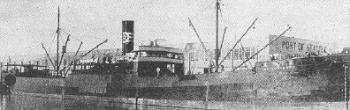 |
|
| Sunk: Anastasia - 3,110 tons
(Officially credited as Nagaragwa Maru - 990 tons) |
| Details: Torpedo Attack #4 on 6/22/44 |
|
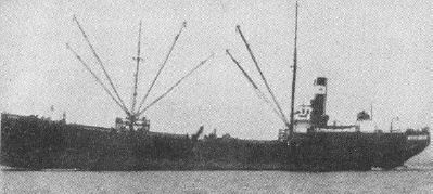 |
|
| Sunk: Isuzugawa Maru #5 - 226 tons
(Officially credited) |
| Details: Gun Attack #1 on 7/1/44 |
|
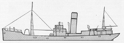 |
|
Here is a side view of a "typical" 274 gross ton steam trawler
(she is
actually the Himeshima Maru, but she appears to be a good example of trawlers of
that size). |
|
| Sunk: Kamoi (or Kamo) Maru - 138 tons
(Officially credited) |
| Details: Gun Attack #1 on 7/1/44 |
|
No picture available |
|
|
Pictures courtesy of Shelley Shelstad and History-on-cdrom.com |
|
